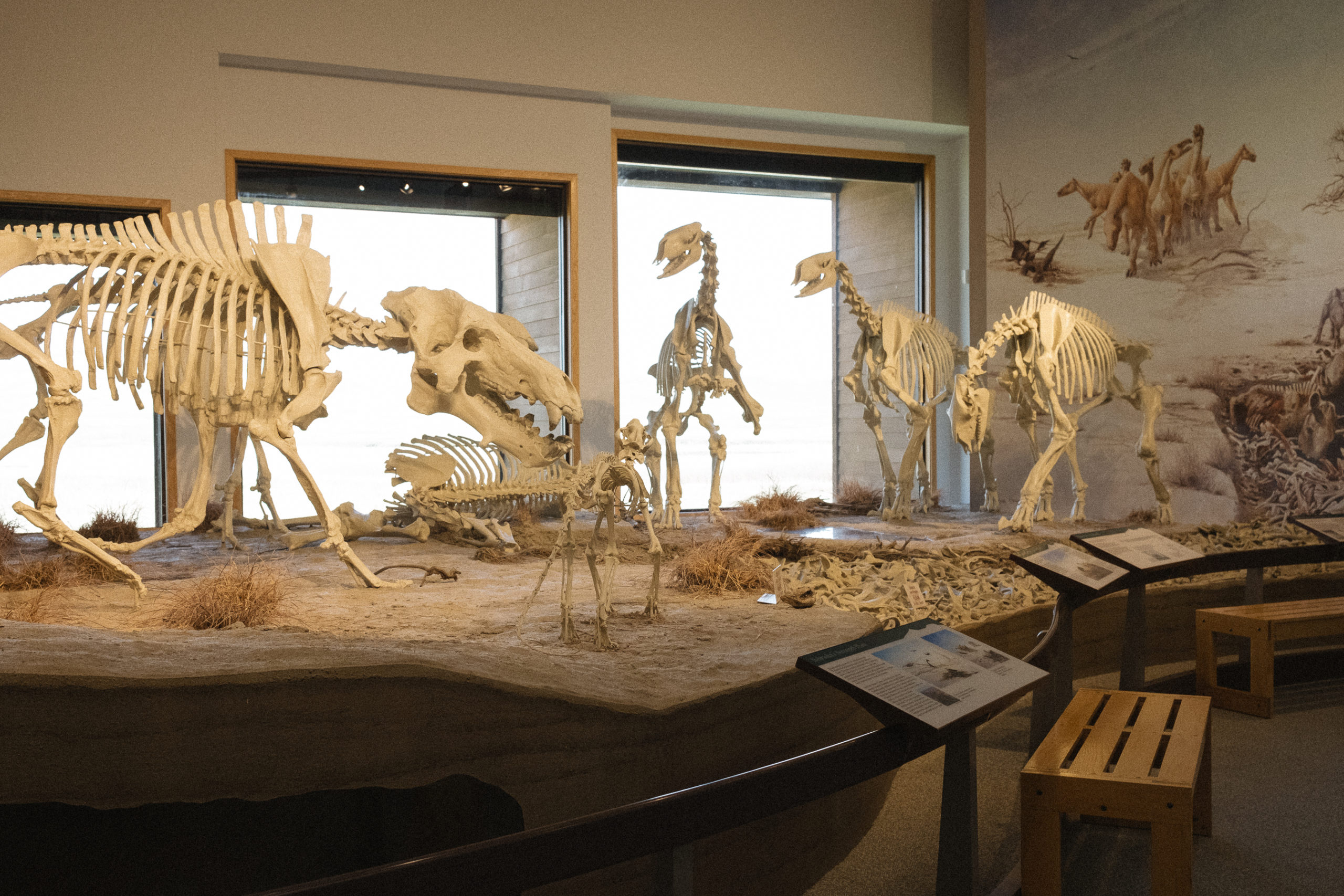
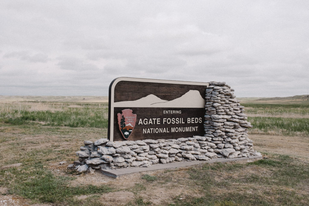
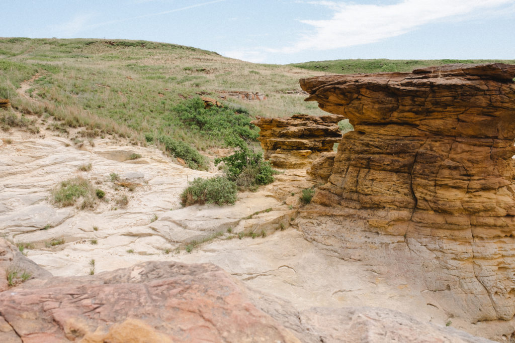
Near the western border of Nebraska in the early 1900’s, full skeletons of extinct Miocene mammals unearthed in the hills lead to the creation of Agate Fossil Beds National Monument to preserve the site and history.
Outside there are nearly four miles of hiking trails, where you can explore the excavation sites – where there are actually still tiny bone fragments to view from the excavation efforts. This national park unit is in a more remote are, but perfect for visiting especially if you are already in the area for Scotts Bluff, or nearby Fort Laramie in Wyoming, or the handful of national parks in southwestern South Dakota.
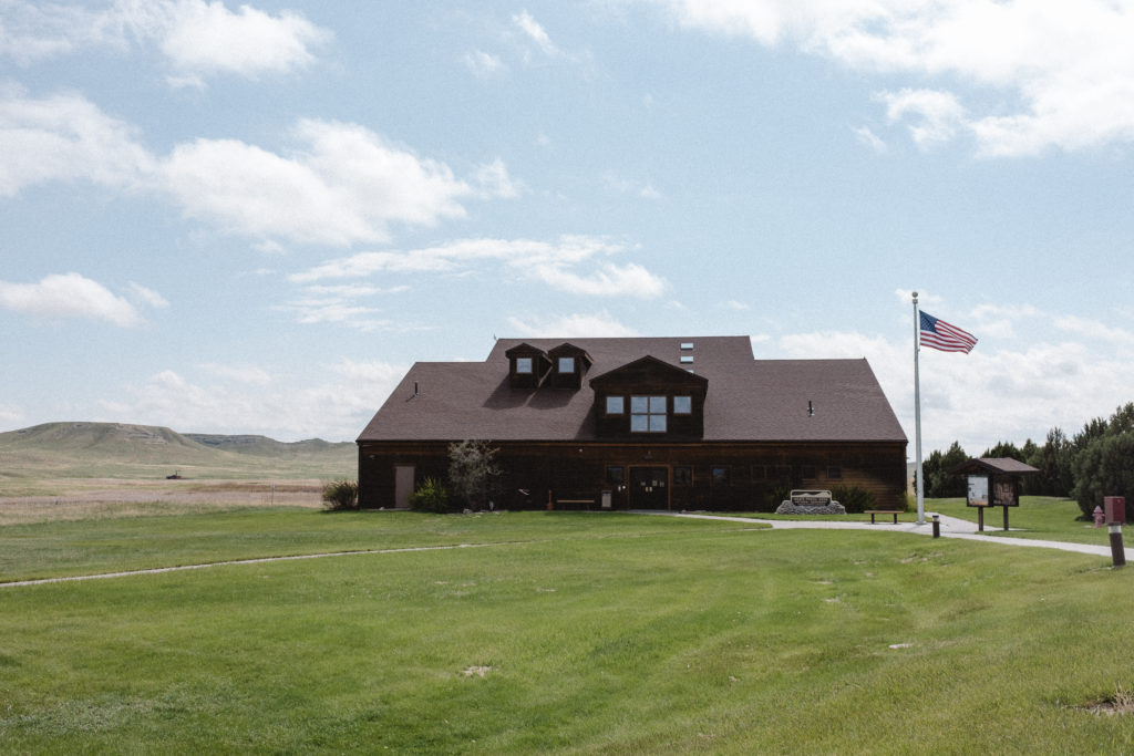
Perfectly preserved fossils displayed near the same location where they were once discovered is not what I was expecting to find in western Nebraska. Highly recommend a visit to Agate Fossil Beds National Monument, and watching the video in the visitor’s center theatre is particularly illuminating. The visitors center is in itself a captivating museum, full of fossils and information with plenty of hands-on interpretive displays.
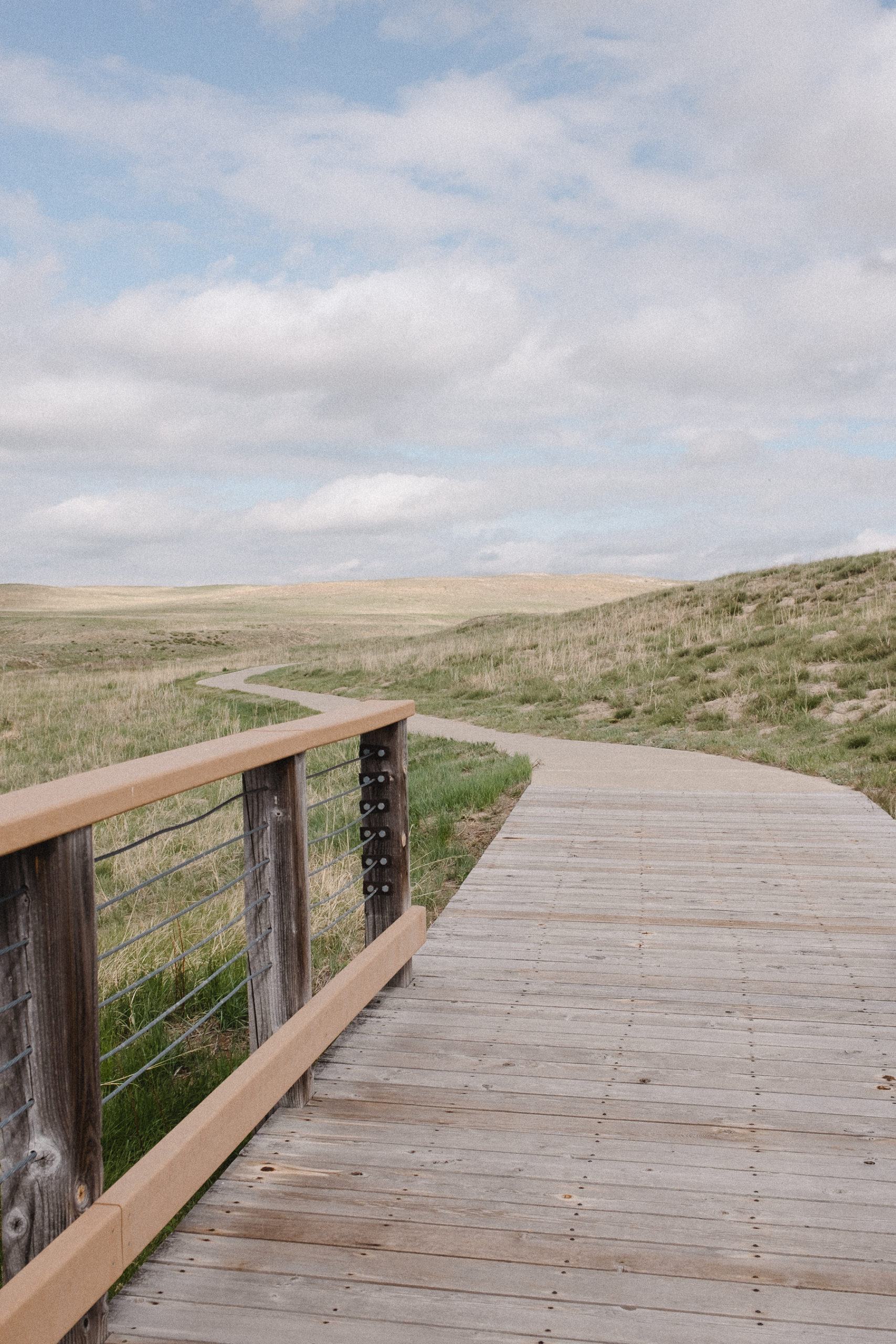
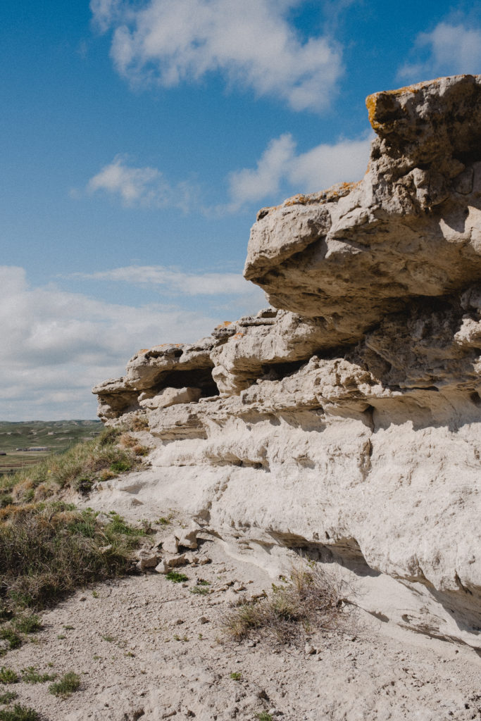
Fossil Hills Trail in Agate Fossil Beds
This 2.8 mile hiking trail is fully paved, and includes a few benches offering a place to stop and rest on the route. There are however, zero trees in the area so sun-protection is a must on the trail. The day we visited we saw about a dozen people throughout our few hour visit. The beautiful weather certainly encouraged a slow-paced exploration of the trails, from viewing tiny bugs to grand expanses of rocky cliffs.
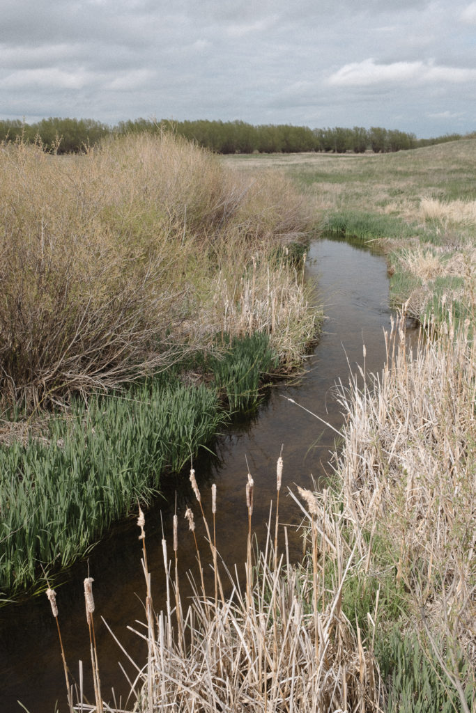
Daemonelix Trail in Agate Fossil Beds
Near the west entrance to the park, you can also enjoy a shorter 1 mile hiking trail, the Daemonelix Trail. It features an exhibit of the fascinating spiral corkscrew fossil of the Paleocastor, an ancient beaver.
National Park Service unit 128/423.
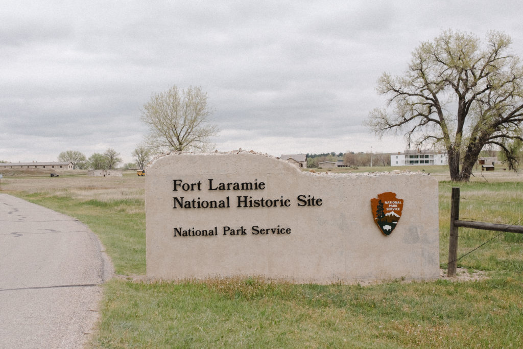
Fort Laramie National Historic Site, Wyoming
23 May, 2022
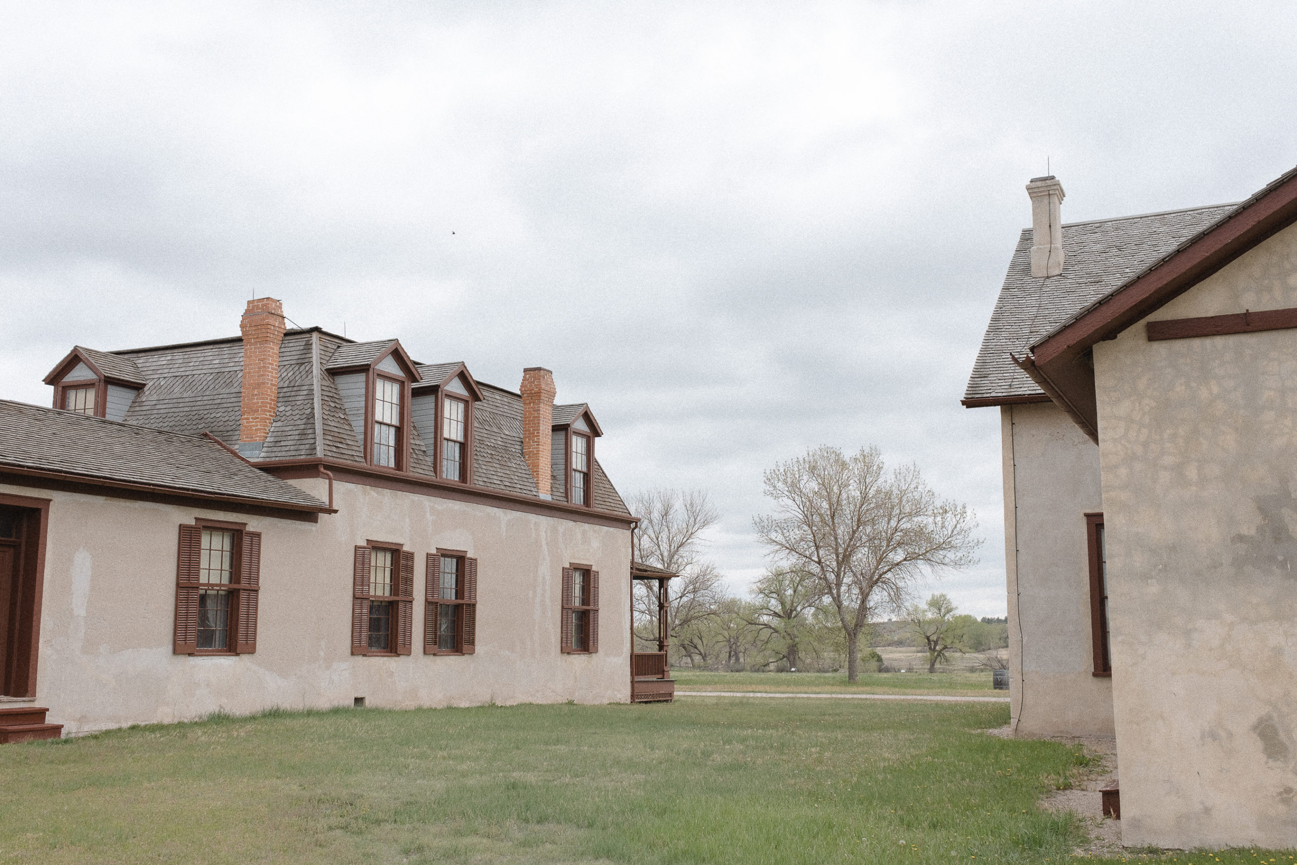
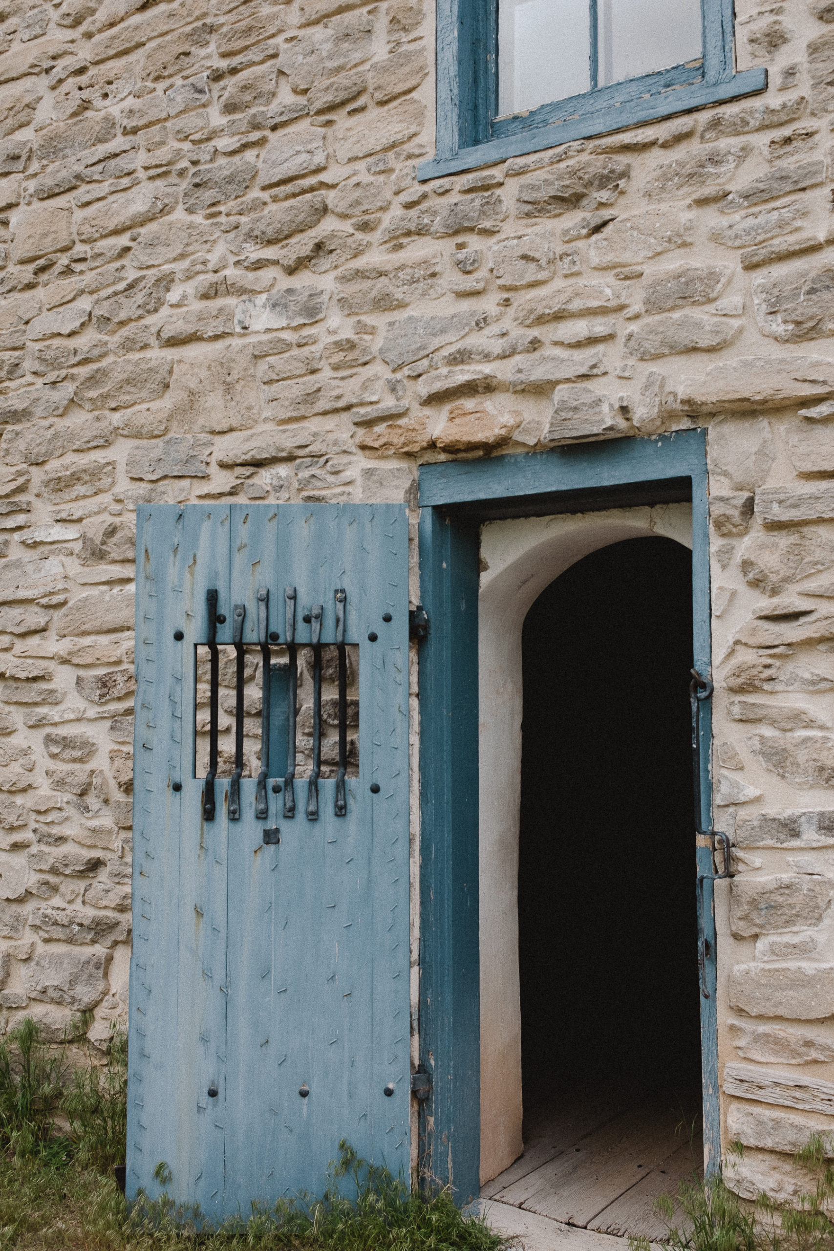
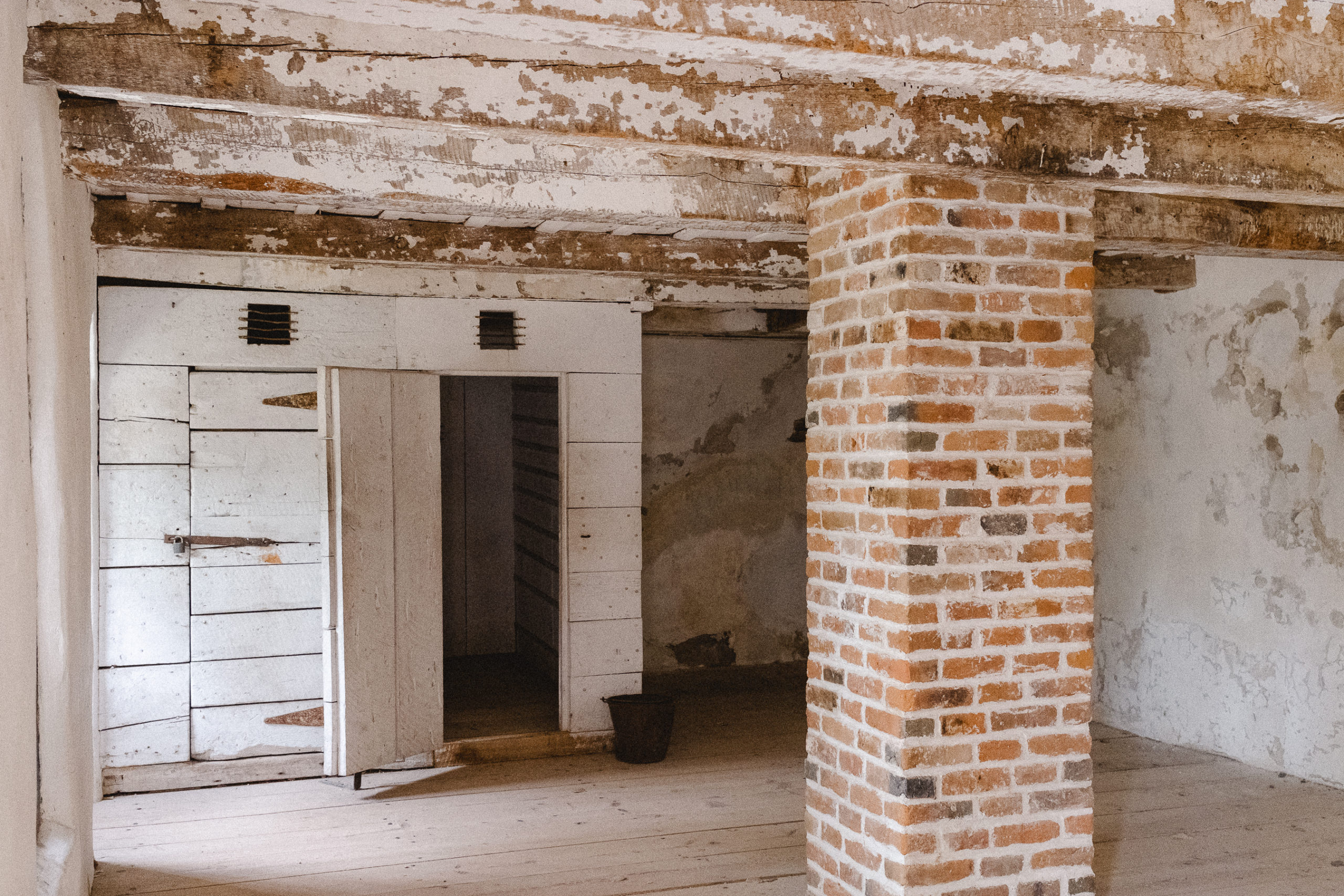
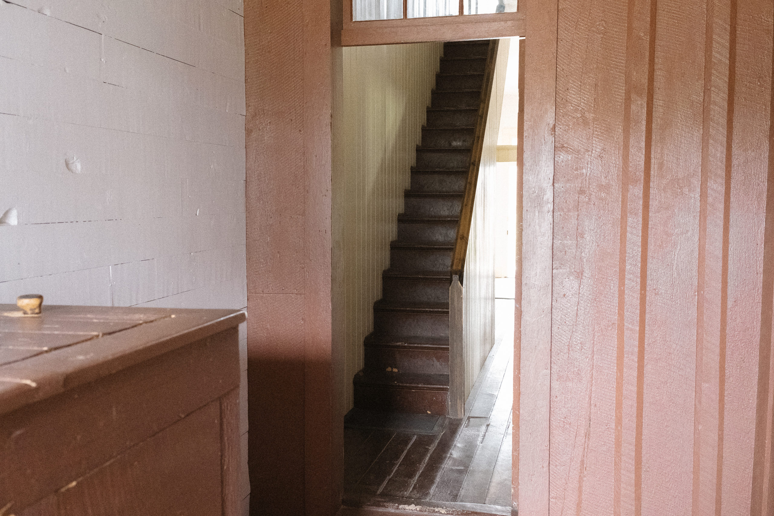
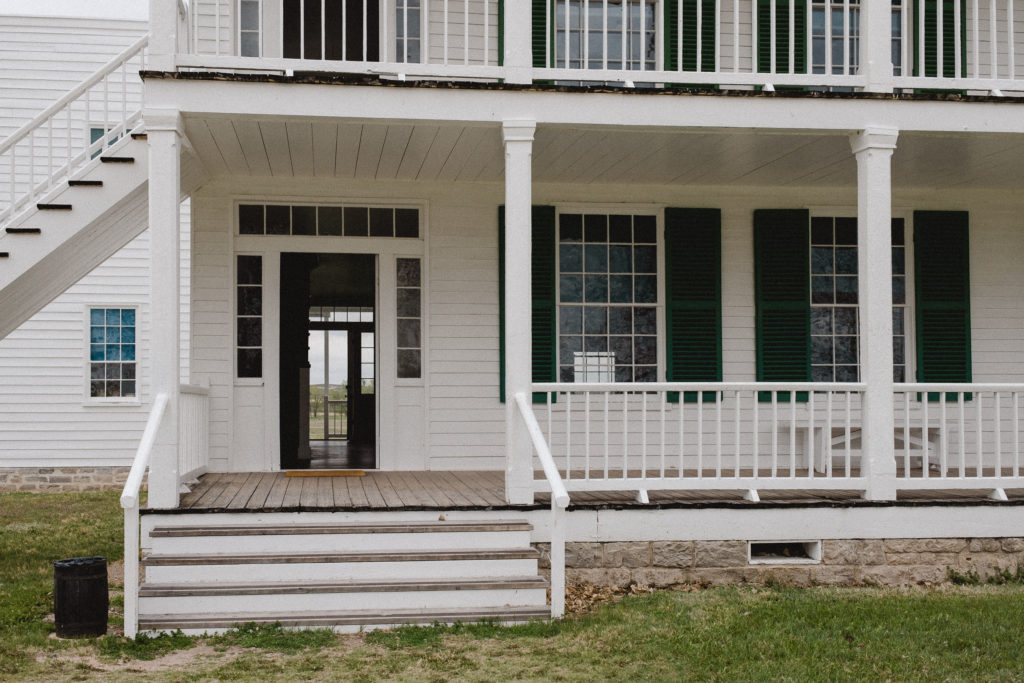
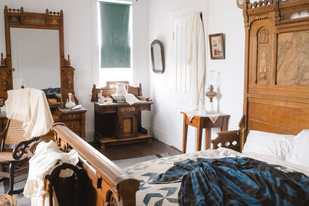
Large historical sites such as Fort Laramie National Historic Site are full of preserved, restored and/or recreated buildings. And when fully furnished rooms to tour, it’s just icing on the cake for me. I find endless inspiration in needlework, handwriting on letters and intricate details in woodwork. I feel like this is one of the many reasons we find such importance in preserving these sites, and also in visiting them.
A summer visit to Fort Laramie National Historic Site.
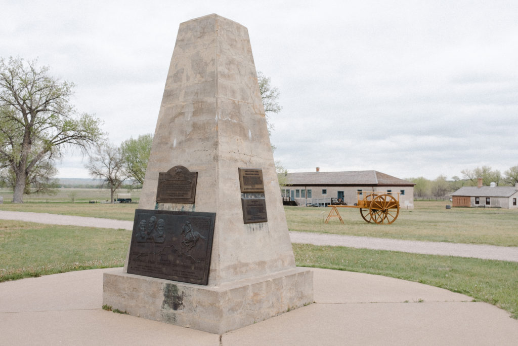
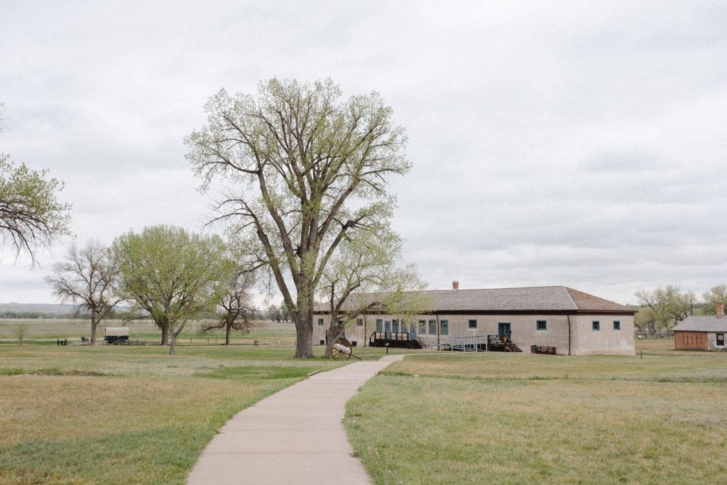
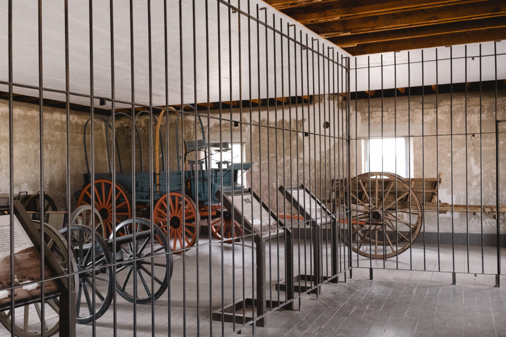
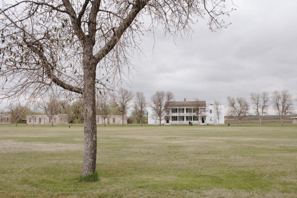
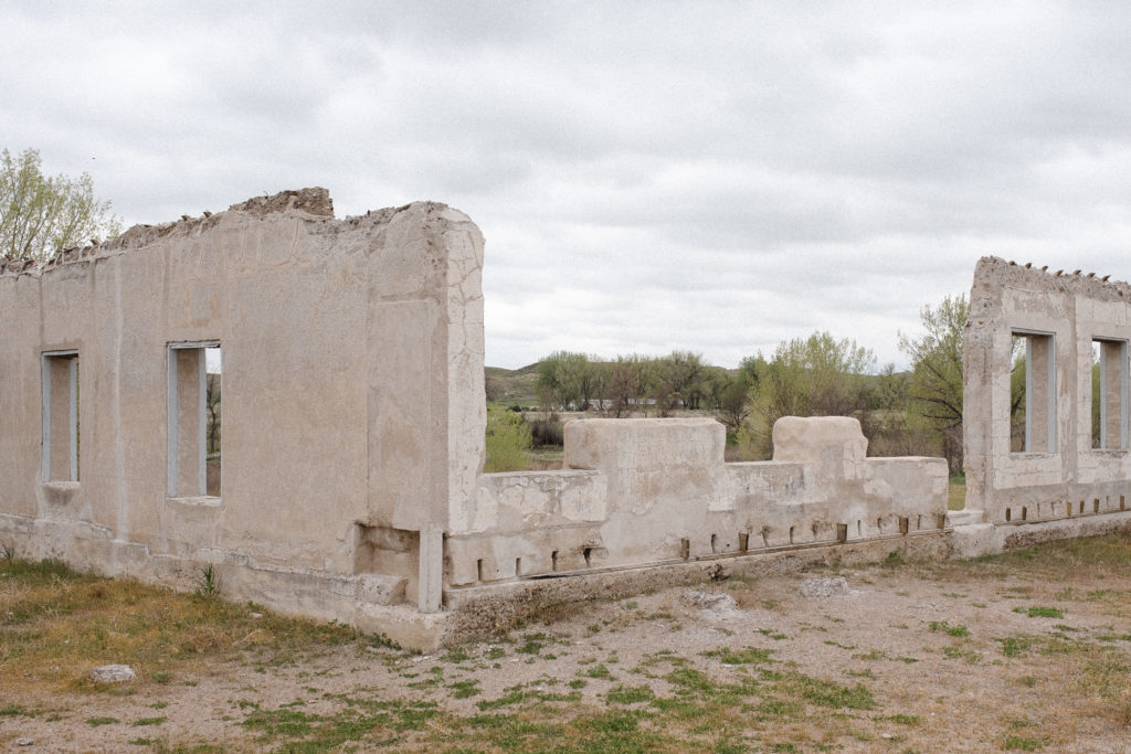
The day we visited Fort Laramie National Historic Site, we pulled into the parking lot to find it quite crowded for a weekday with six school buses and a dozen or so cars. Yet the grounds at Fort Laramie are quite extensive. It’s not challenging to find solace while walking through twelve restored buildings and ruins in various stages of disrepair.
Fort Laramie National Historic Site is a short one hour drive from Scotts Bluff National Monument, and less than an hour and a half drive from Agate Fossil Beds National Monument, both in Nebraska. We visited all three of these national park units in one day, without feeling any rush.
Watching the video in the visitor’s center is a great starting point to become familiar with the history of the park. It also gives great information on the general reason for each building’s existence. This park offers a great way to spend an afternoon touring at your own pace.
Wavy glass appreciation.
One feature of the original buildings I particularly enjoy is the original “wavy” lead glass windows. First seeing wavy glass frequently praised on Cheap Old Houses posts, I now appreciate its merits and a little shriek escapes me when I catch it out in the wild, like here.
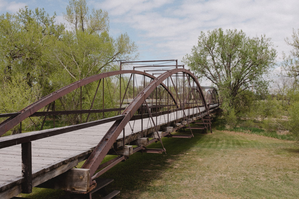
Old Army Bridge
Confluence National Recreation Trail starts near the Old Army Bridge, forming a 1.6 mile loop to the confluence of the Laramie and North Platte Rivers and back. The bridge, built in 1875, is built of wrought iron and spans 400 feet. A historical marker from the 1950’s reads “This bridge was a vital link between Cheyenne, Fort Laramie and the Military outposts, Indiana Agencies and gold fields of the Black Hills, Dakota Region.”
National Park Service unit 127/423.
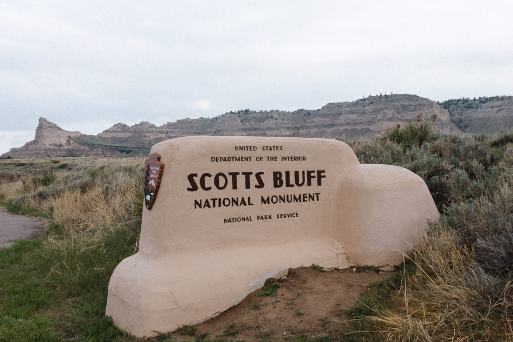
Scotts Bluff National Monument, Nebraska
23 May, 2022
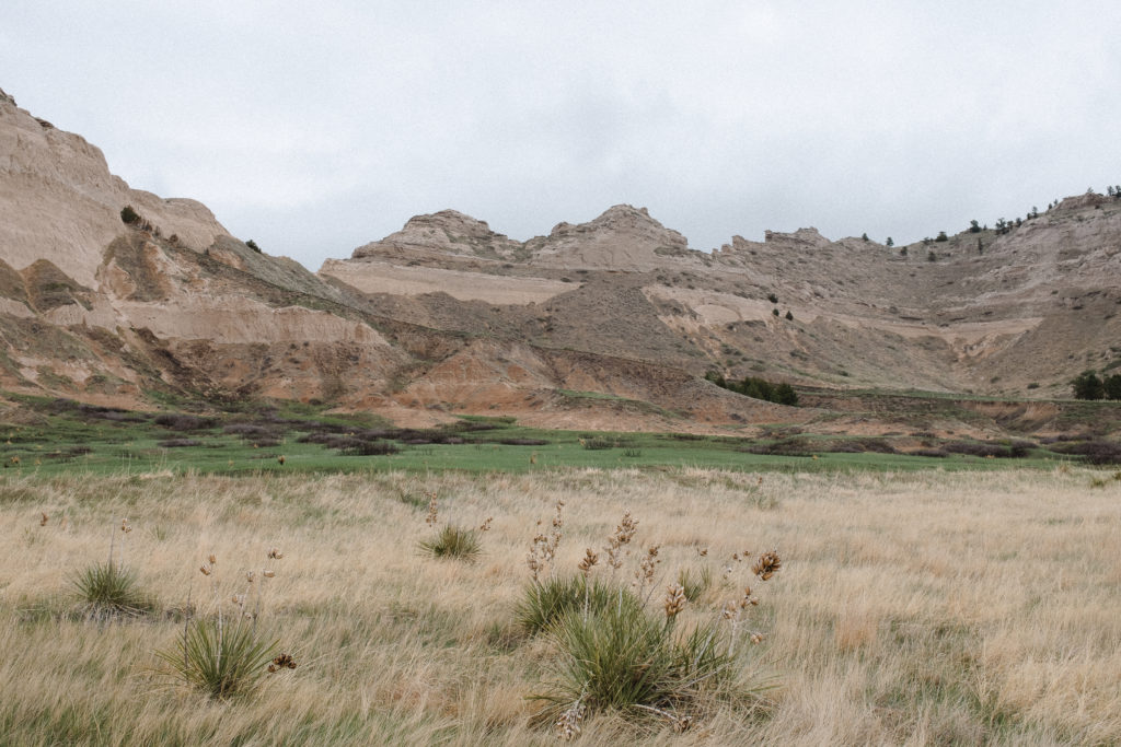
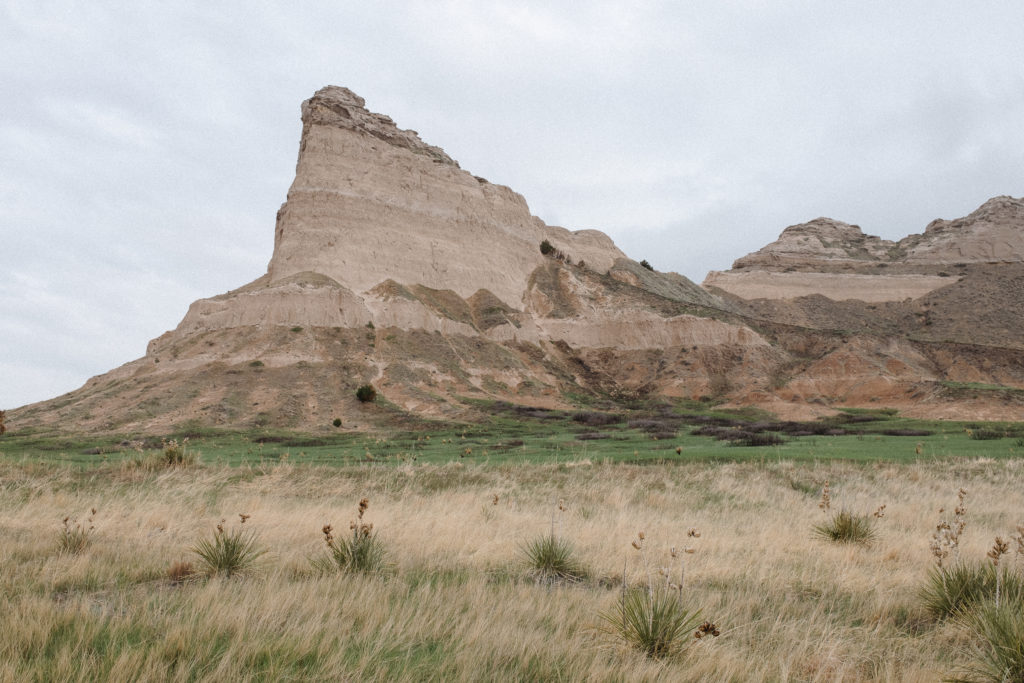
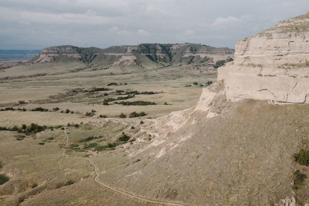
Scotts Bluff National Monument in Gering, Nebraska stands an impressive 800 feet above the North Platte River surrounded by the plains of Nebraska. Stop in to the visitor’s center first to greet and learn about the history of the area from cheerful and pleasant park rangers who are genuinely interested in their park.
We camped a short distance away at Riverside Campground, which actually offers great views of Scotts Bluff. We set up a tent, enjoyed complimentary firewood, and the campground even has a bathroom/shower house on site. The campground is adjacent to a zoo, so the sounds of animals are occasionally present. I believe we heard a few dozen monkey calls in the night, though they weren’t disruptive enough to challenge good sleep.
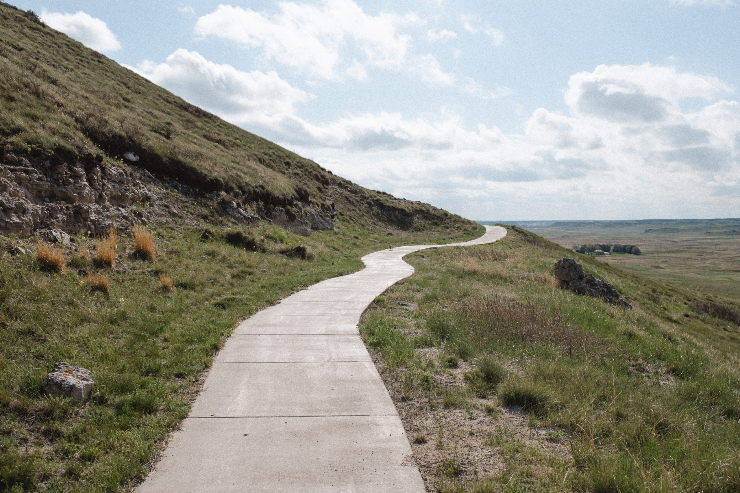
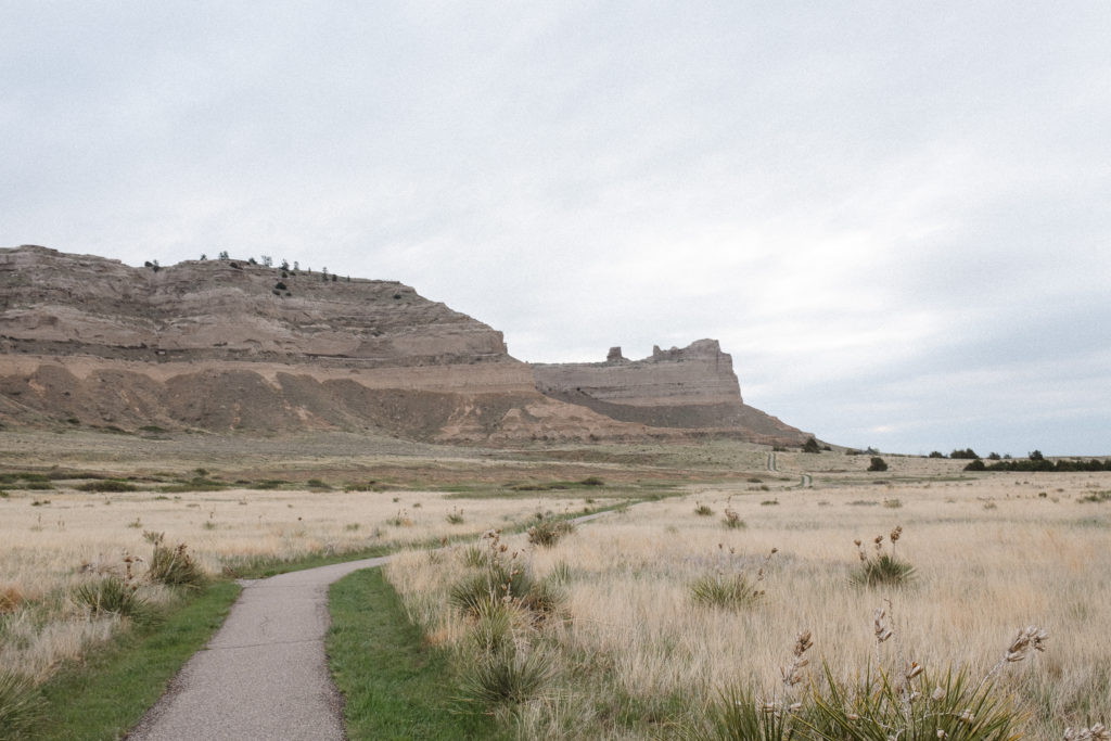
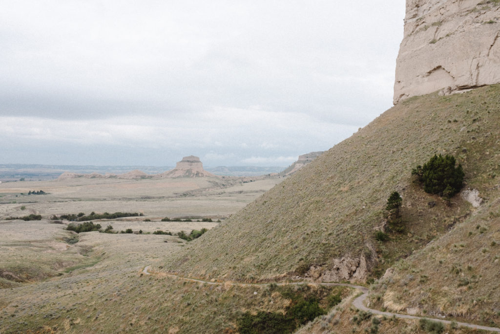
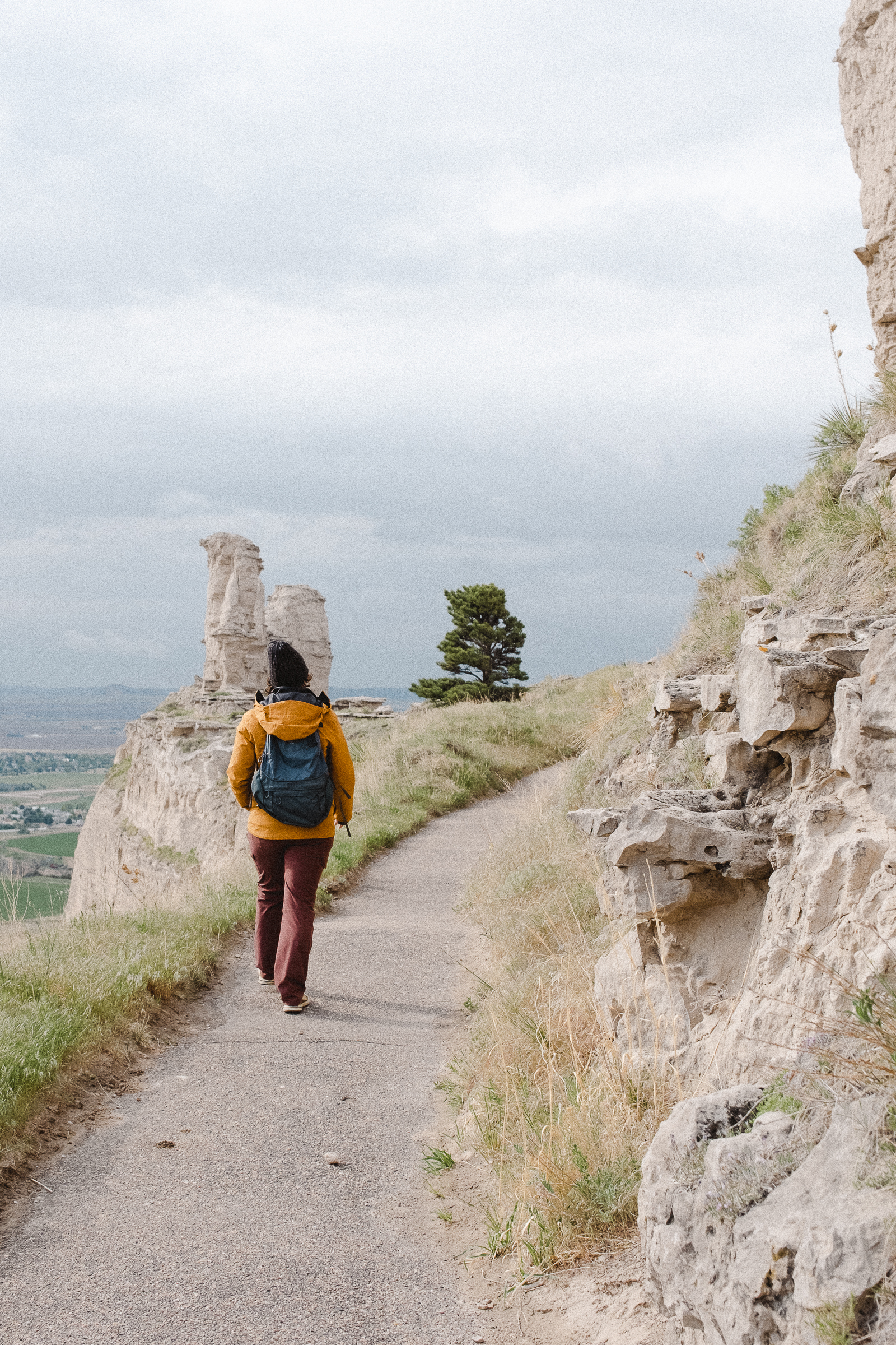
Saddle Rock Trail
The 3.2 mile roundtrip hike from the visitor’s center to the summit of Scotts Bluff is absolutely stunning. It is fairly steep, but I feel like the trail gradually ascends at a mostly comfortable rate. The views from the top of the endless prairie with a city nestled near on one side are remarkable.
Scotts Bluff National Monument is the first of nearly a dozen national park units we are visiting on this week-long road trip. And it fully impresses. Scotts Bluff has long served as a landmark for peoples from Native Americans to emigrants on the Oregon, California and Mormon Trails. The landscape is stunning from the bottom, and just gets better and better as you hike the 1.6 mile trail to the summit.
There are nearly four miles of hiking trails to experience at Scotts Bluff National Monument. We did walk most of the available trails while here, as the day is exceedingly beautiful. All are paved, and at least on our chilly visit, uncrowded.
The higher you ascend the trail, the more breathtaking the views become. One of the (many) favorite parts of hiking for me, is looking back to see just how far I have come. This is a trail to easily see your advancement, as most of the hike is ascends one side of the cliff.
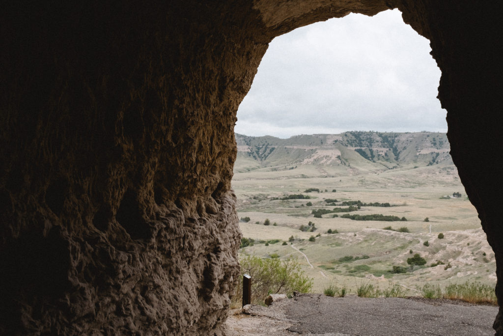
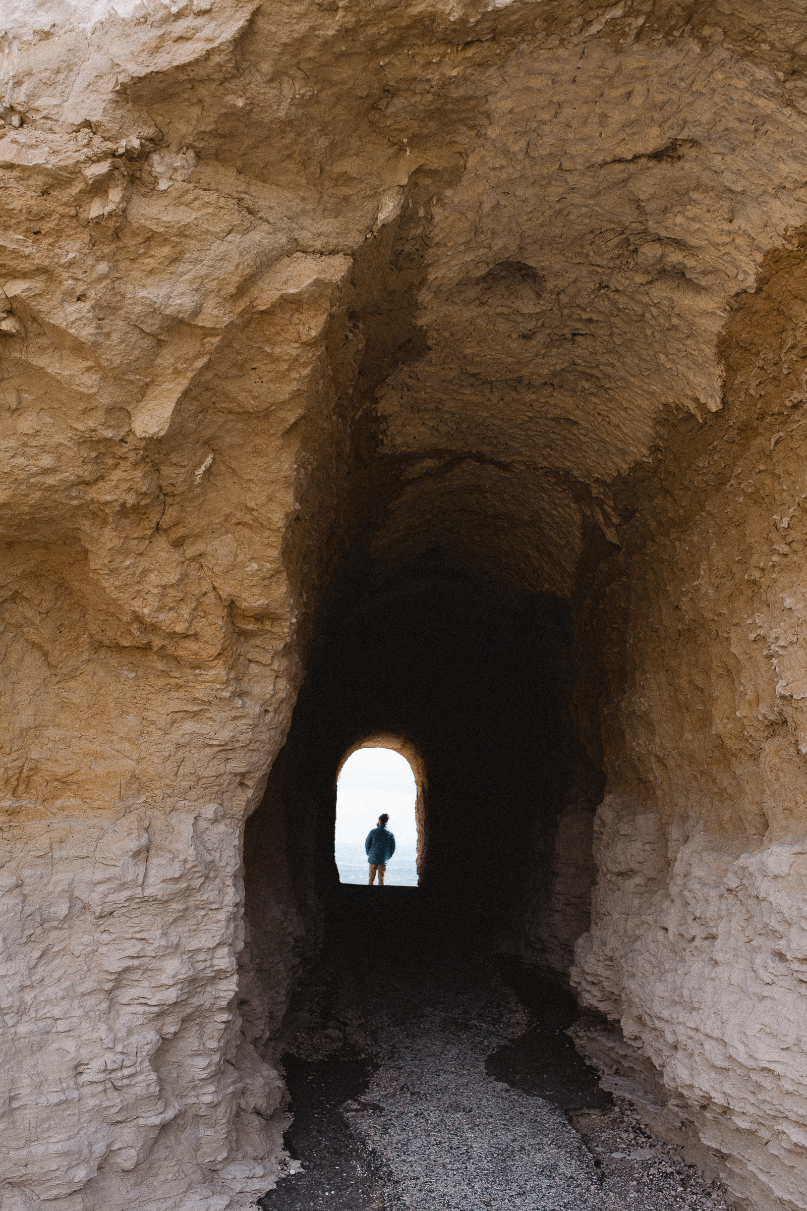
A Picturesque Tunnel
A key feature of the Saddle Rock trail hike the summit, is when the trail travels directly through the rock forming a surprising and beautiful tunnel. In this area you can’t help but notice the cliff swallows and white-throated swifts fly through the air. Watch closely to find their nests made from mud plastered to the cliff sides.
Is there anything better than the weather being chilly enough for a jacket and beanie during a summer hike? Coming from Oklahoma just the previous morning, I thrilled to embrace the colder weather.
Wildlife Viewing
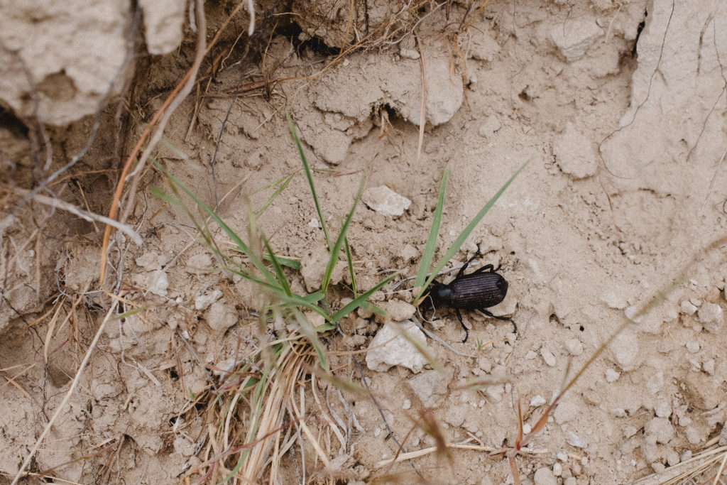
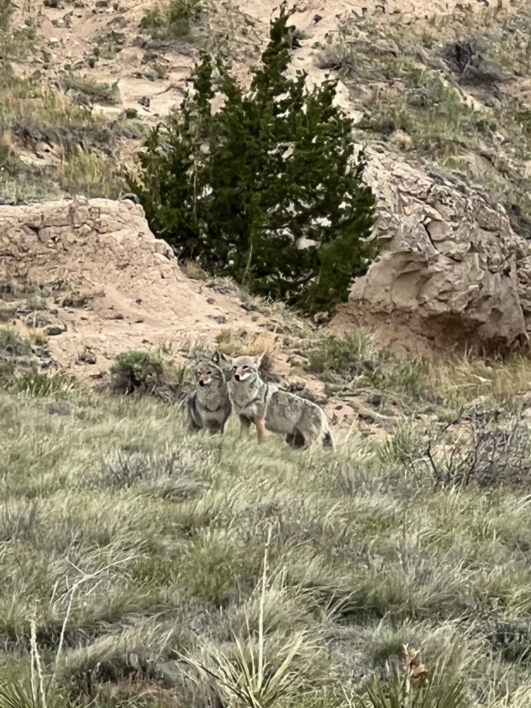
Amusingly enough, the first sight of wildlife on our hike happened near the end. We laid eyes on a little beetle digging in the dirt, and I said “Look, our first wildlife viewing.” A few more steps along the path met us with two coyotes trotting up the hill, mere feet from us! An incredible experience, we stood and watched greedily as they cleaned one another’s ears and surveyed the land.
National Park Service unit 126/423.
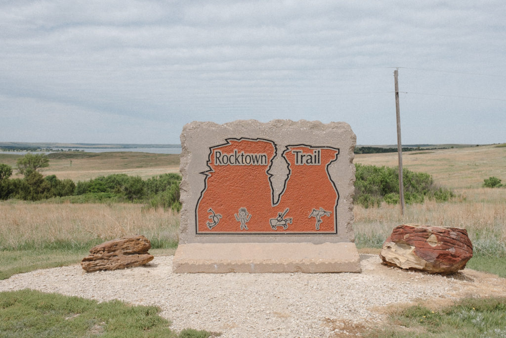
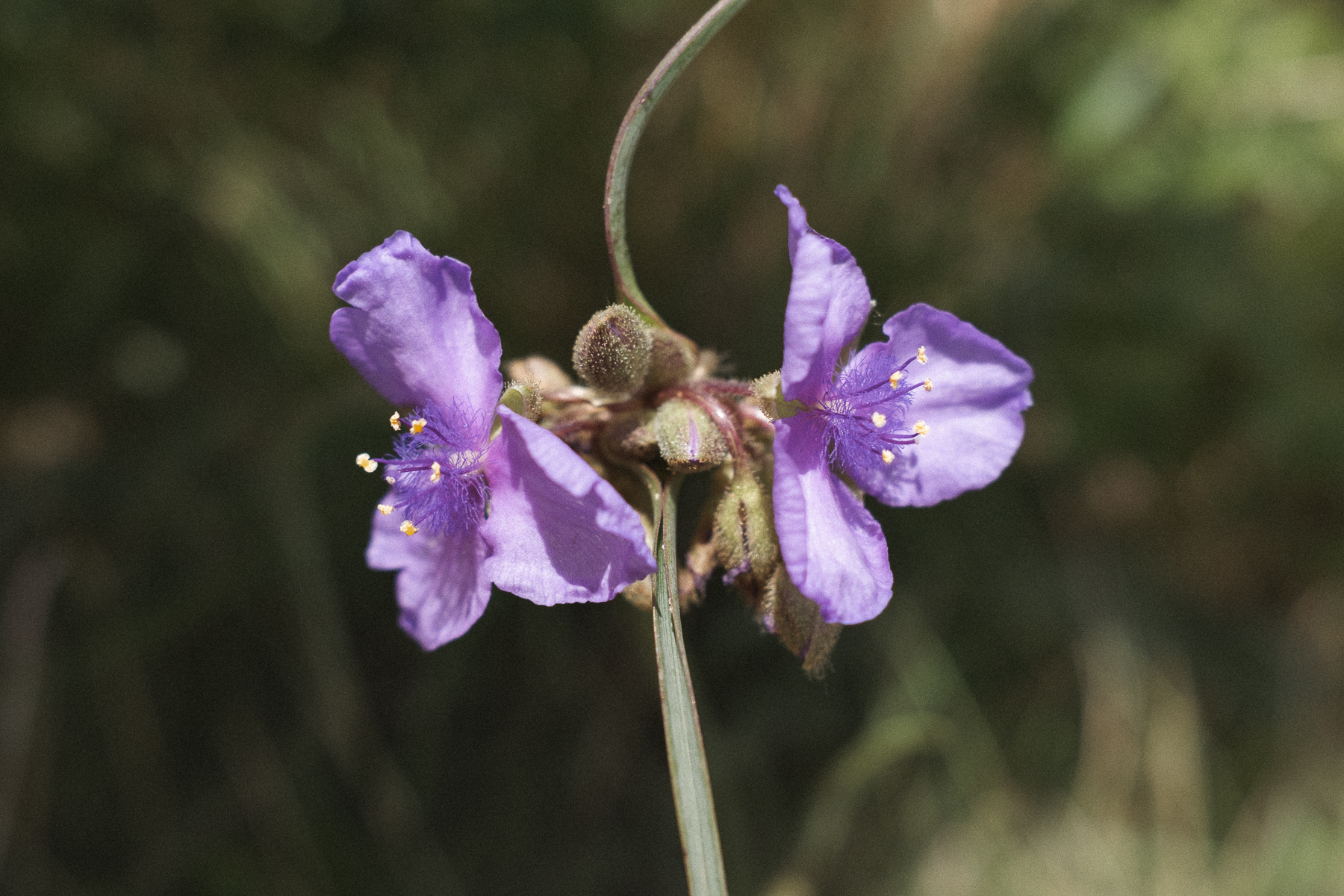
Hiking in Kansas - the Rocktown Trail
22 May, 2022
Always ambitious but not always the best at following through, I am currently more than halfway through a personal challenge – to walk 1 million steps in 100 days. Seemingly dramatic, it simply maths out to 10,000 steps a day. I’m full of determination to accomplish this challenge, to prove that I can in fact follow through for myself and for no other reason.
Trusty Atlas
And so on day one of a road trip in which we would be driving 10+ hours, I was mildly anxious about how to find the opportunity to walk 10,000 steps as well as sit in a car the majority of the day. Pouring over my atlas, to my surprise I found a hiking trail, Rocktown Trail, a short distance off the interstate on our route. A quick google search confirmed not only was there a hiking trail, but it was listed on multiple sites as the best hiking in Kansas. The best hiking in all of Kansas… Who knew?
Hiking in Kansas
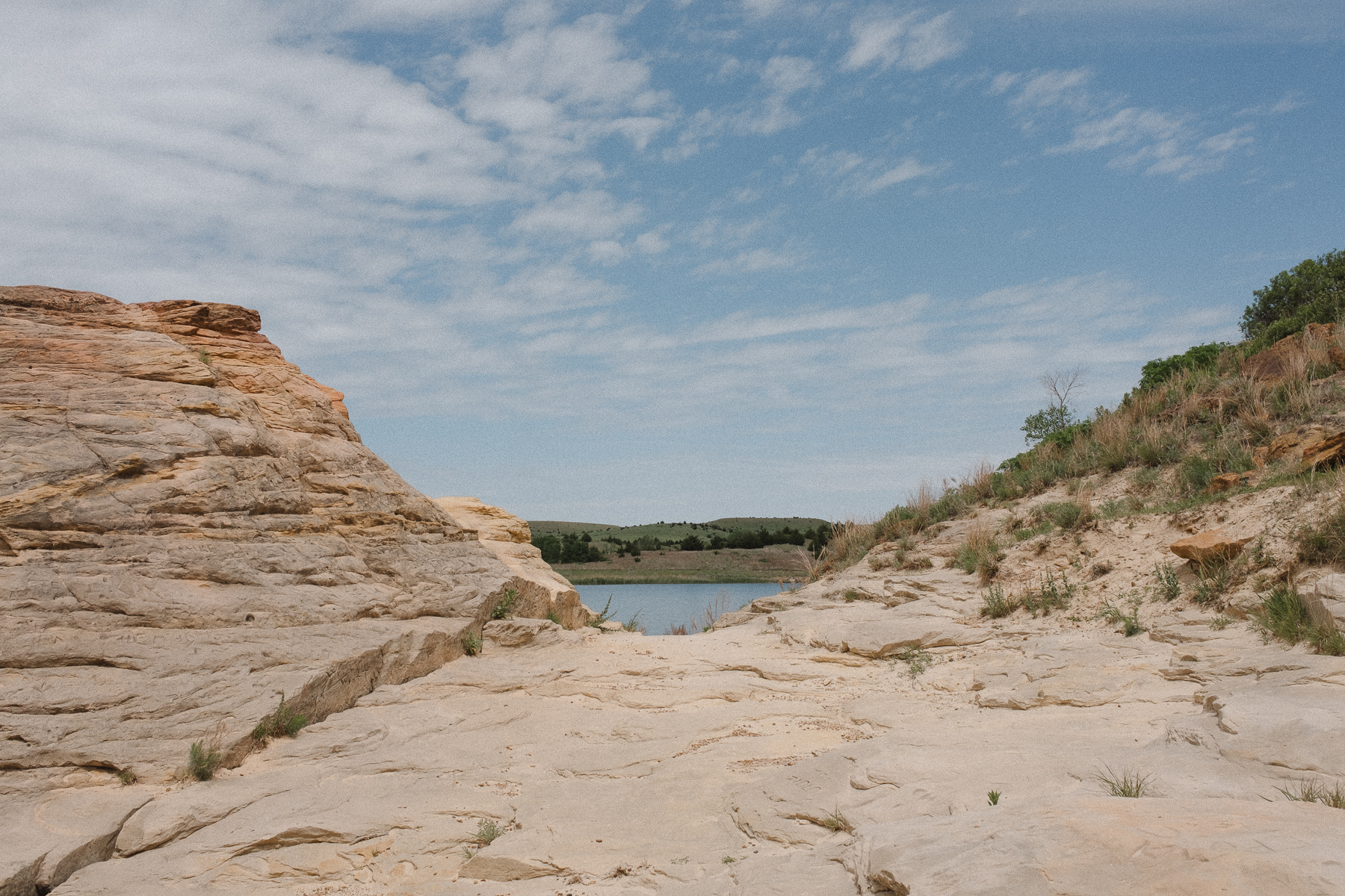
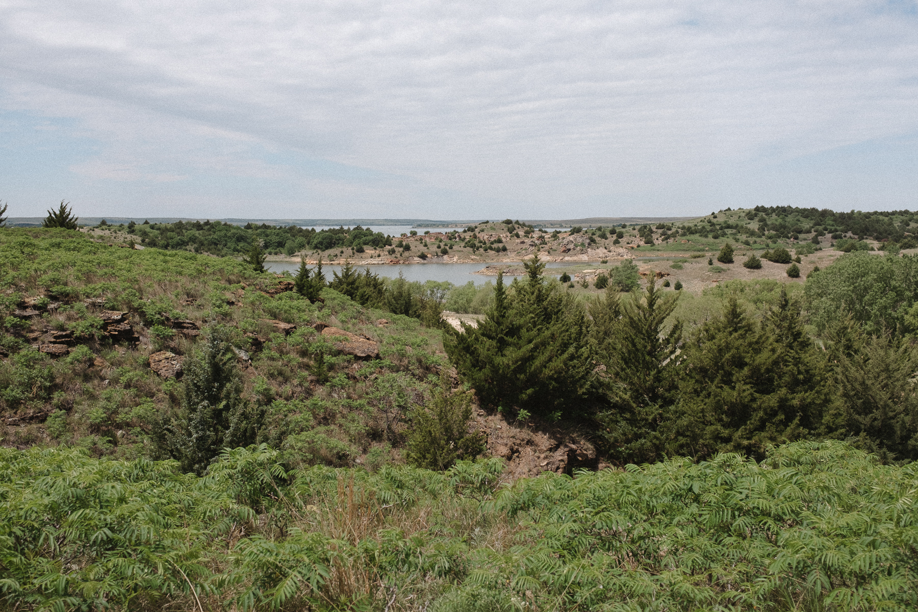
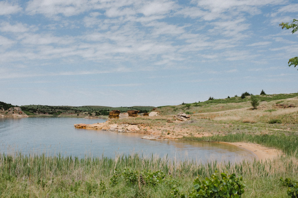
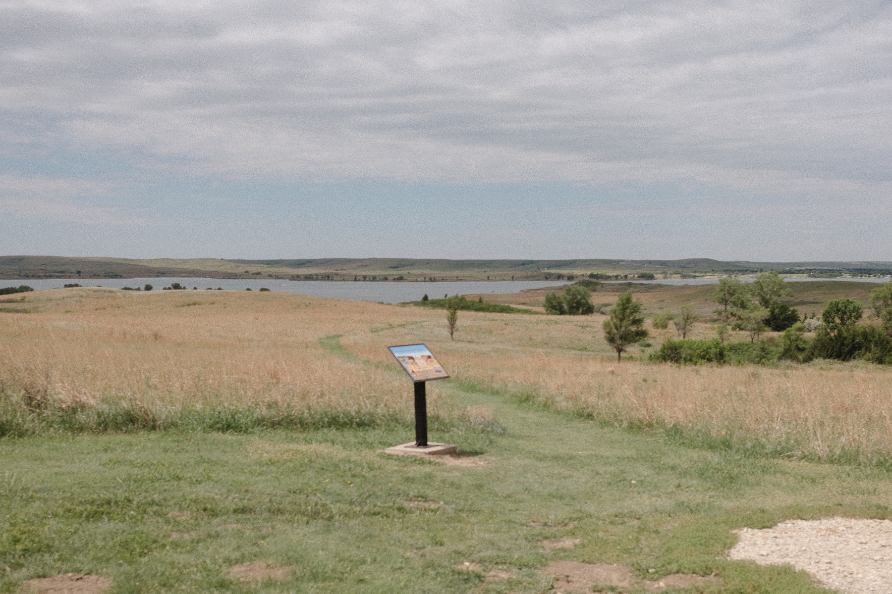
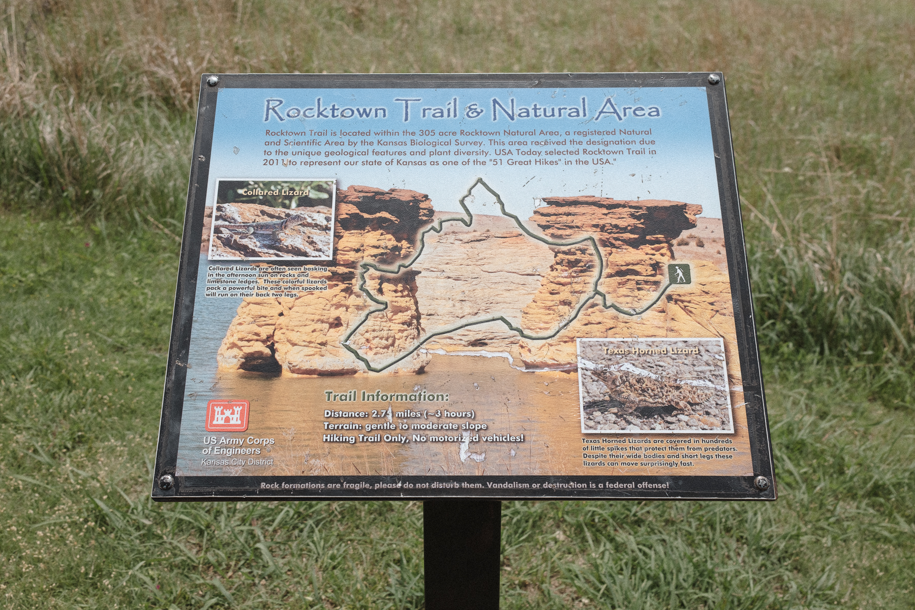
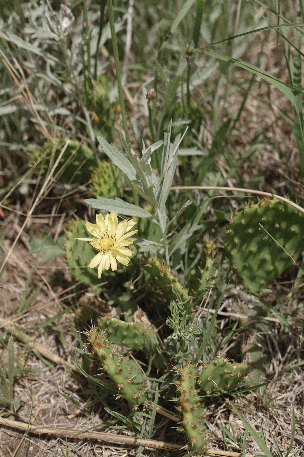
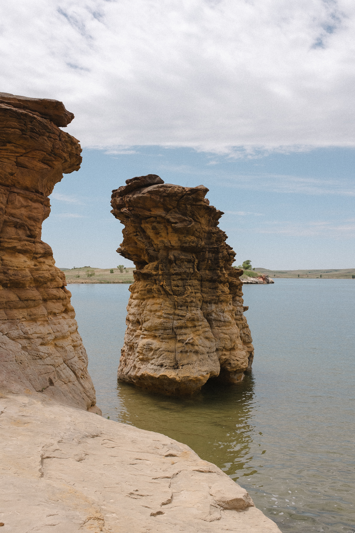
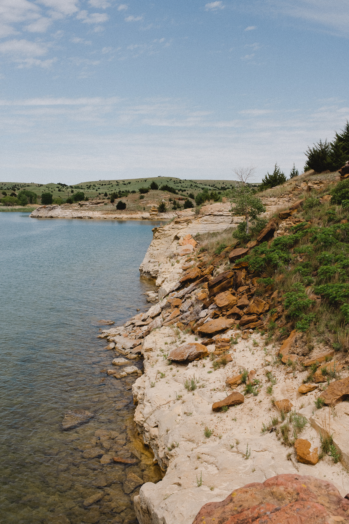
Located along the Post Rock Scenic Byway about 5 miles north of I-70 in the heart of the Smoky Hills, you will find Wilson State Park. A large scenic lake is nestled in the vast hilly grassland and features tons of outdoor recreation including boating, swimming, biking and Rocktown Trail hiking. The most striking aspect of the park is the red sandstone rocks towering over the lake, 15 to 30 feet tall.
Rocktown Trail begins at a small parking area with room for 4-5 vehicles, winds up and down the rolling hills to the lakeshore offering exploration opportunities of the sandstone rocks and cliffs. Before the trail leads you back up a loop to meet back at the parking area. The trail is 2.5 miles in total, though exploring the shoreline can easily add an extra quarter mile to your hike.
Hiking in the Midwest
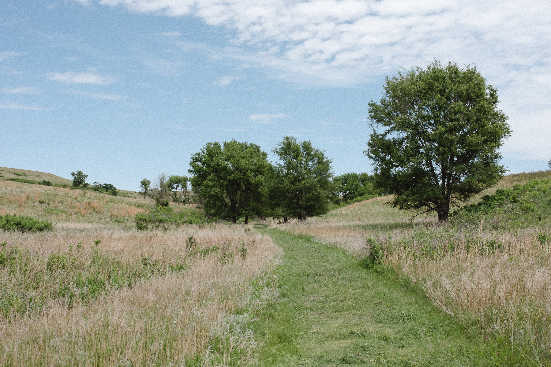
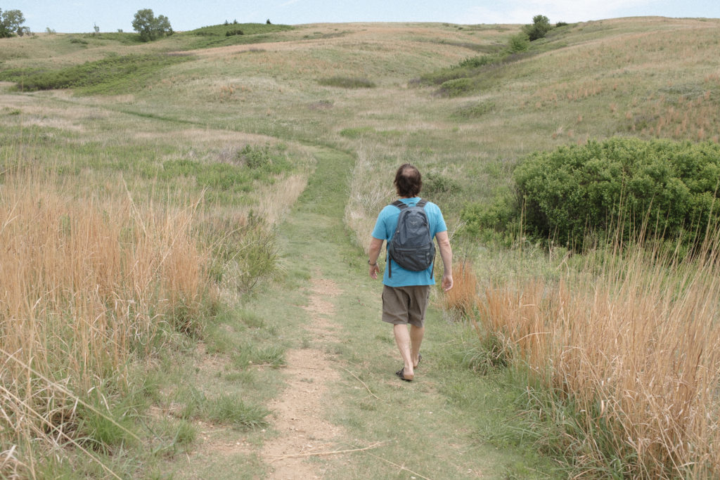
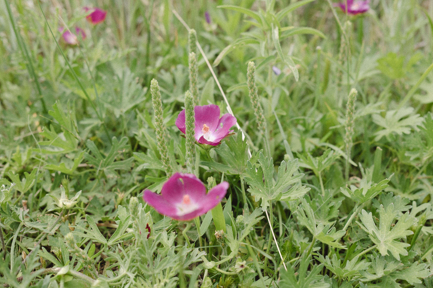
Only in the midwest do we find this particular hiking trail, where instead of gravel or rocks or a dirt path, the trail is simply a wide strip of grass mowed down short to guide your walk. There is a particular beauty to find in a grasslands trail. Rocktown Trail features a wide variety of wildflowers, sagebrush, yucca and a small hedgehog cactus, buckthorn and woolgrass, poppymallow and veratrum. Not many trees dot this landscape, though you’ll see a handful of elm and poplar trees near the start of the trail. It’s definitely a hike to bring a hat of other form of sun cover during the heat of the summer.
Picnic Break
Bringing a small backpack with a picnic lunch and water, we chose to make the most of our break from time spent in the truck. A beautiful Sunday afternoon greets us on the day we visit, the temperature staying in the mid 60’s, the sky partly overcast. Since you can take the loop trail either direction, we passed by only two other couples on our hike who opted to hike clockwise to our counter-clockwise. When we got to the shore, a family was enjoying a break on their boat at the feet of the cliffs. Otherwise, we had the Rocktown Trail all to ourselves.
State parks typically get less attention than national parks, but they are simply miniature versions of national parks. After all, most national parks begin as state parks or another type of protected area.
Rocktown Trail truly lives up to the name of one of the best hikes in Kansas. The juxtaposition of sandstone rock and grasslands are stunning, and the accessibility of visiting are certainly worth a detour to get out of your car and stretch your legs and take in a bit of uncrowded beauty in nature.
The First Attempt.
26 Feb, 2022
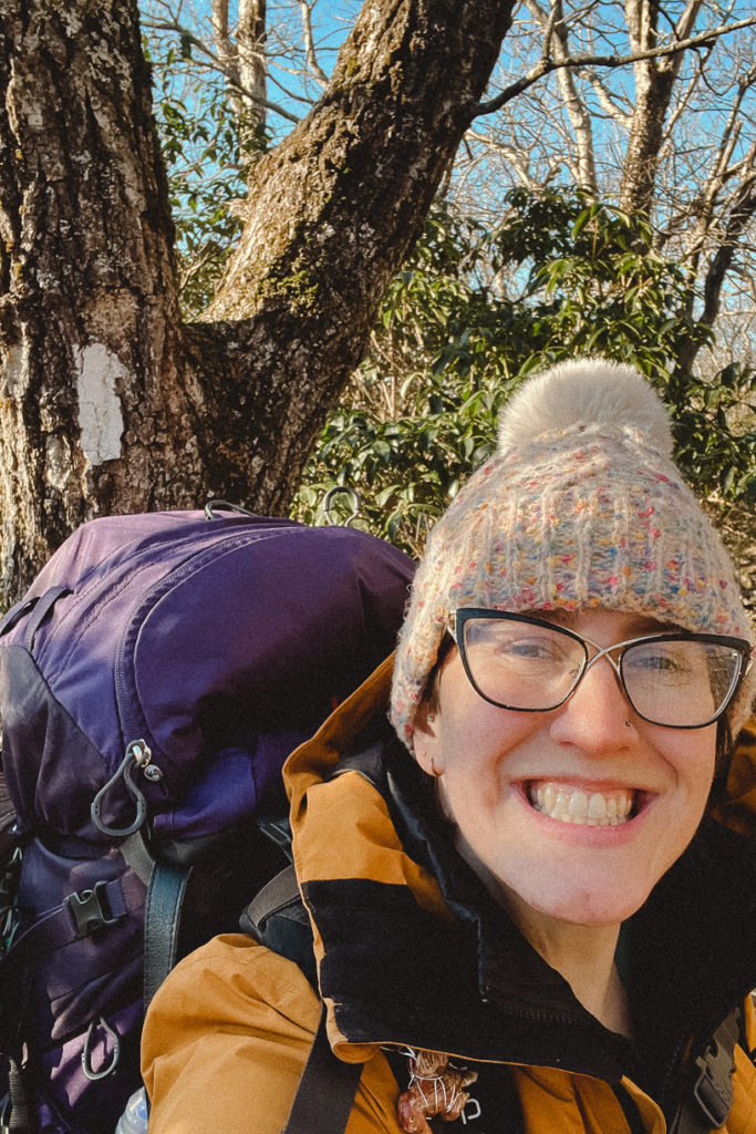
So, my thru-hike of the Appalachian Trail did not go as expected. I am sitting back home in my warm and comfortable and familiar bed, a good five+ months before I intended to. But I do not feel like a failure. I succeeded in several things. I gave it my best try. Several things were learned along the way on the first attempt of the Appalachian Trail.
I got to know myself better.
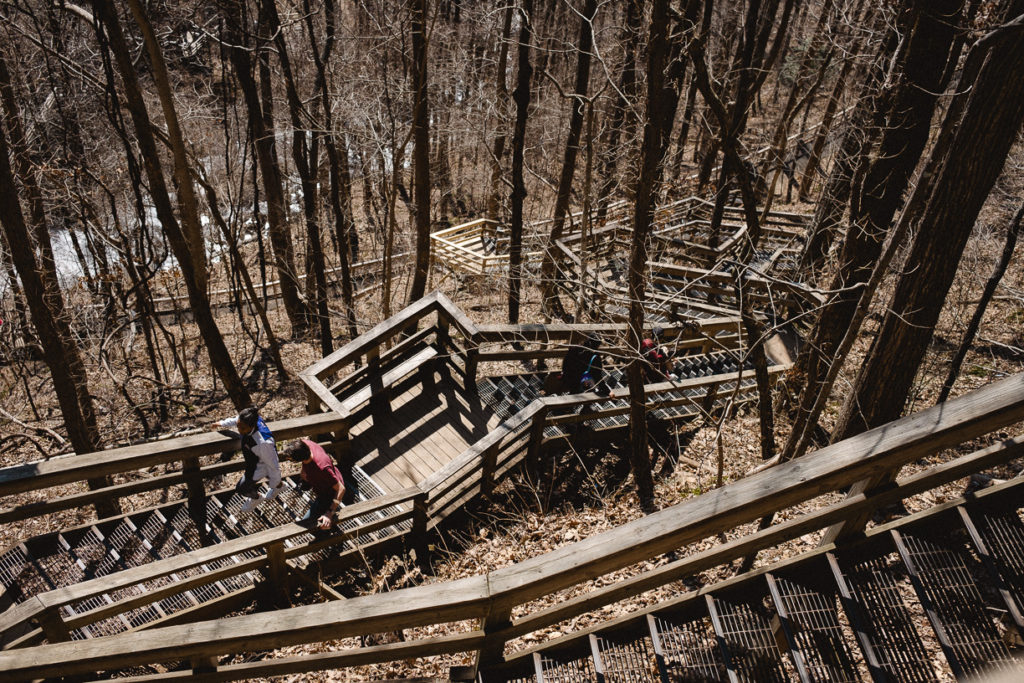
The trail is no joke; it is hard beyond any hike I’ve embarked on so far in any state. Honestly carrying a 45 pound bag, including five days of food and two liters of water, on a flat and leisurely trail would’ve been a monumental achievement. Just climbing the 600 steps up Amicalola Falls had people without backpacks taking frequent rests.
But what really was the deciding factor to get my broken down self off the trail, was the biting constant cold. There’s a massive difference between enjoying cold weather, as I sincerely do, and being stuck in freezing weather 100% of the time. With no reprieve day or especially night. I shivered long into the night. Shivering caused by both the literally freezing temps, and also my fear. Fear of sleeping alone in the woods, strange noises, possible animals, unknown humans. The combination was brutal for me.
Unexpected Misery
It was to the point where every moment was simply misery. Each footstep accentuated pain. Each incline seemed an impossible mountain to climb. And I know for a fact it doesn’t have to be that way. I love so much about hiking, backpacking and camping in the wilderness. I just wasn’t finding any of that usual joy in any capacity. So I left the trail, to return in warmer weather which will be here before we know it.
When I finally was honest with myself and decided to get off the mountain, I texted the first shuttle driver I could find. To my delight, she answered within 30 seconds, and picked me up within 90 minutes. The hour long drive I spent with her was so illuminating, and I feel like I was simply meant to meet her during my journey.
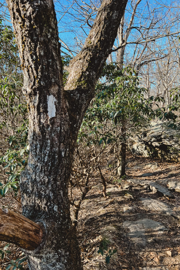
During our conversation I brought up how I’d hiked endless miles in other states, in states with taller mountains with higher elevations and rockier trails, but none had been this hard. She simply said “Georgia doesn’t believe in switchbacks like other states do. So instead of trails meandering up 1,000 feet over gentle switchbacks, Georgia is like bam! Good luck with all 1,000 feet in one go, sucker!” It makes absolutely perfect sense. I had noticed the lack of switchbacks, but hadn’t put two and two together.
Future Attempt(s)
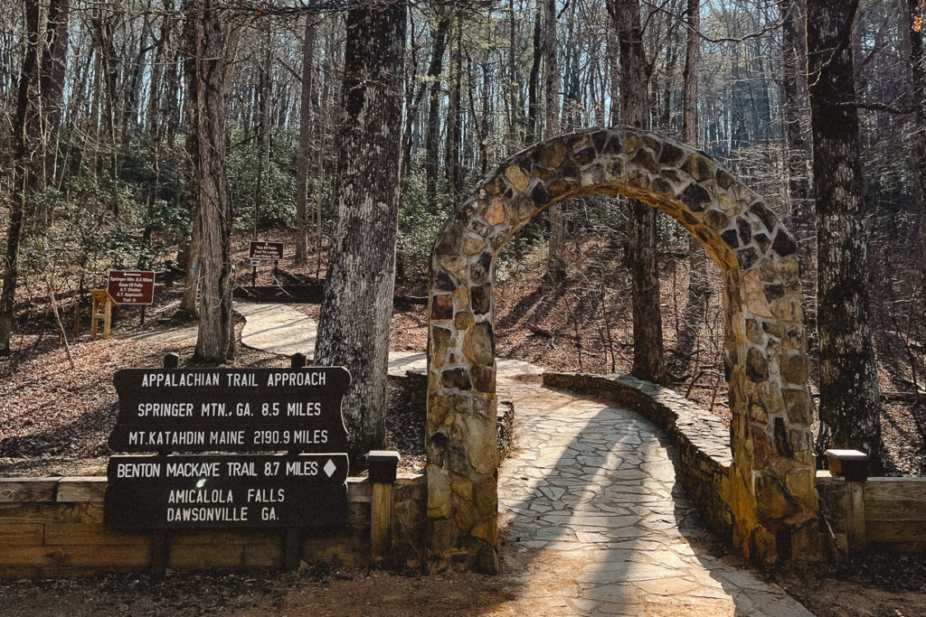
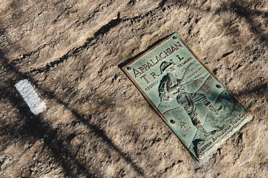
I haven’t given up on my dream of hiking the A.T. Far from it. I have to do it smarter, listening to my body and being realistic with my needs. I’m hoping to return to the trail this spring, either starting where I left off in Georgia, or doing a flip/flop hike starting in Virginia. There was nothing like the moments I laid eyes on the first white blaze of the trail, along with the plaque and register in the rock, the shelters and privies and all of the sights I had been seeing online and hearing tales about. Finally seeing them for myself was such a moving experience in itself. So although the first attempt of the Appalachian Trail did not go as planned, it will not be my last attempt.
So, here is a pause in my pursuits, and that’s okay. I have to hike the hike that is most comfortable and makes the most sense to me – even if I have to learn exactly what that means for myself along the way.
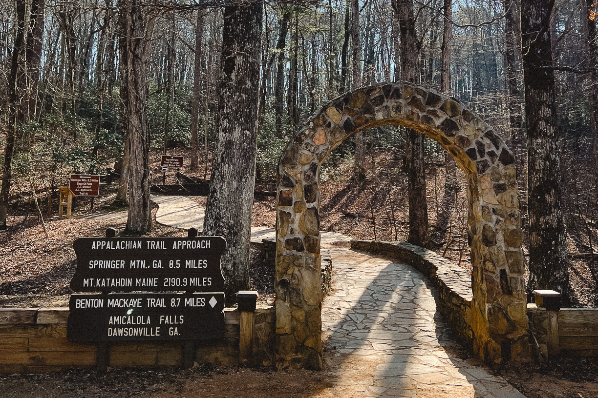
On the Road to the Appalachian Trail
28 Jan, 2022
And just like that, seven months have passed by like a breath – and I am finally traveling east on the road to the Appalachian Trail toward the approach trail in Dawsonville, Georgia.
On the Road to the Appalachian Trail
This past summer when I decided on the idea to hike the full 2,200 miles of the Appalachian Trail just seven months later, it feels just as wild and just as exciting now as it did then. With each passing week, and decision, and hour spent researching, I am closer and closer to the reality. And yet it feels just as unreal and far away as ever.
This past week specifically has been a wild ride. Cleaning and packing and a whirlwind of seemingly endless decisions being made left and right. It has me excited, and a little nervous. And mostly just ready to start.
Endless Decisions Around Every Corner
One of the most exhausting aspects of planning for this trip has certainly been the sheer amount of decisions that had to be made. Decision Fatigue is absolutely real and I struggle with it frequently. There came a point in most days, especially when researching gear to buy, when I had to just stop and put down my laptop and simply stop thinking about it for a while.
Only Hours Remain
And now that mere hours, and not weeks or months, remain until I step foot on the trail – I feel prepared and ready. The forecast shows fairly favorable conditions for the most part. The highs for the next 10 days are mostly in the mid-50’s – my favorite hiking temperatures. And nights are in the 20’s and 30’s, which is colder than I’d prefer. But I am confident my gear is up for it.
20 Day Feelings
8 Jan, 2022
I process fear rather slowly. Fear presents itself, I acknowledge it, I try to put the emotion away while I think about the practicalities. It may take awhile before I am able to bring the emotion back out and look it in the eye and confront it directly. In fact, it may take multiple attempts. But as I separate the emotion from the realities, it helps me to eventually process both aspects. It is what works for me, or rather, it is what I do.
Preparing for the Appalachian Trail
I fear many things about my upcoming thru hike of the Appalachian Trail. I’m afraid the cold, and the hot, and the insects, and the people. I’m weary of the wild creatures, and the injury possibilities, and the unknowns and the what ifs. Around every turn, over each rock, in the shadows of the tree line awaits possible imminent dangers.
I’m trying to find a balance between recognizing fears and not dwelling on them. Because the opposite is just as true. Endless opportunities of wonder await me just as much. I am more of an optimist, so I’m sure I romanticize the positives naturally. But there is a balance between recognizing both, not necessarily equally, but making sure not to completely cancel either.
Only three weeks remain until I set foot onto the Appalachian Trail. How much can one accomplish in three weeks? I feel this overwhelming desire to make an endless list with every possible task that exists to accomplish and spend the next 21 days spending every waking moment working on and crossing off each task one by one. And on the flipside of that, I feel a desire to take it slowly, enjoy every comfort and relish in the every day joys that will soon be behind me. In reality, I am leaning into the second desire much more.
Since my last day at my job a couple of weeks ago, I’ve been enjoying waking up slowly and without an alarm, reading or otherwise relaxing, taking long baths, and generally just living slowly and quietly. I feel like it is what my body needs right now, and I’m doing my best to listen.
There are many things that should happen before three weeks is up. Dehydrated meals that should be made. Deep research into trail towns and stops and resupply points, etc. Practice hikes and strengthening my endurance in preparation. But how to prioritize the shoulds, when all my body and mind wants to do is rest?
In the days leading up to the new year, I saw three different “word search” style images with the caption “The first word you see will be what 2022 will bring you” on social media. And coincidently, even though they were three different word searches posted by three different people at three different times – I saw the same word first in each images:
Rest.
How serious should I take that coincidence when if fact I am about to walk 2,200 miles in 2022? The exact opposite of resting? Should I question my decisions? Nah. I’m choosing to see it as a rest from my past. A break from self-imposed and societal pressures. A pause from the hustle and grind of a life I ended up feeling so lost in.
Although I’ll be putting my body into the highest level of activity I’ve ever done, I will be walking into a type of rest that I don’t find in my current every day life. The peace and quiet of the wilderness, in combination with excluding the distractions of electronics and the noise of a bustling city.
It turns out rest is what I’m seeking, and I hope I am able to find the type of rest that will result in healing.
40 Day Anticipation
20 Dec, 2021
I’ve always been the person to enjoy the planning process nearly as much as the actual journey. I’m always planning the next adventure, and the one after that, and more than likely the one I’d like to take in three year’s time. It’s just such a part of the thrill. Dreaming, and researching, full of pure anticipation. And planning for the Appalachian Trail is no exception to the enjoyment.
40 days remain until my Appalachian Trail start date. Since I last stopped and took stock, there were 60 days remaining. A lot has happened in the past nearly three weeks, but also not a lot. 20 days ago, I was still spending all free time researching and shopping and making certain the purchases I made would be the best possible choices. Now, I am getting over a week-long sinus infection and taking things slow.
It’s Getting Real
I have just three more days of work left before my last day at my retail job. It feels thrilling to be quitting – but also terrifying to know I will have no source of income for the foreseeable future. Everything is up to my savings account from here on out. I’ve read accounts of thru-hikers who made it over a thousand miles on the trail and yet had to give up due to their savings running out before anticipated.
I feel I planned and saved well enough that this particular fear will not be my case, but it’s still a legitimate fear.
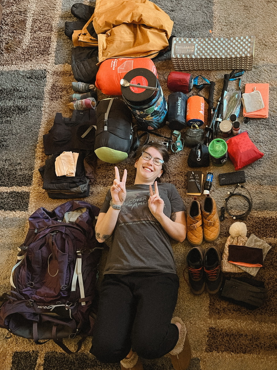
Before my biggest concern was finding the perfect camera to take on the trail. Something light-weight and compact, but also high-powered full of the tech that will create the highest quality images. It was quite a checklist. And I’m so thrilled I was able to find the camera in stock and it’s currently sitting beside me as I type this. After acquiring the camera, it seems like everything else is a little more simple.
I also upgraded my very scratched and shattered Samsung S8 phone, found and broke in the pair of hiking boots I will start the trail with, and – for the moment – my shopping is complete.
Three more days of work, then Christmas, then New Years. Then only 28 days will remain until looking upon the rock arch at the approach trail to the A.T. These next couple of weeks are going to fly by, and I will feel simultaneously under and over prepared. Planning for the Appalachian Trail feels like about 95% of my focus at any given time, but that’s not necessarily a bad thing.
A few things I want to focus on in the final 39 days days of preparation of planning for the Appalachian Trail:
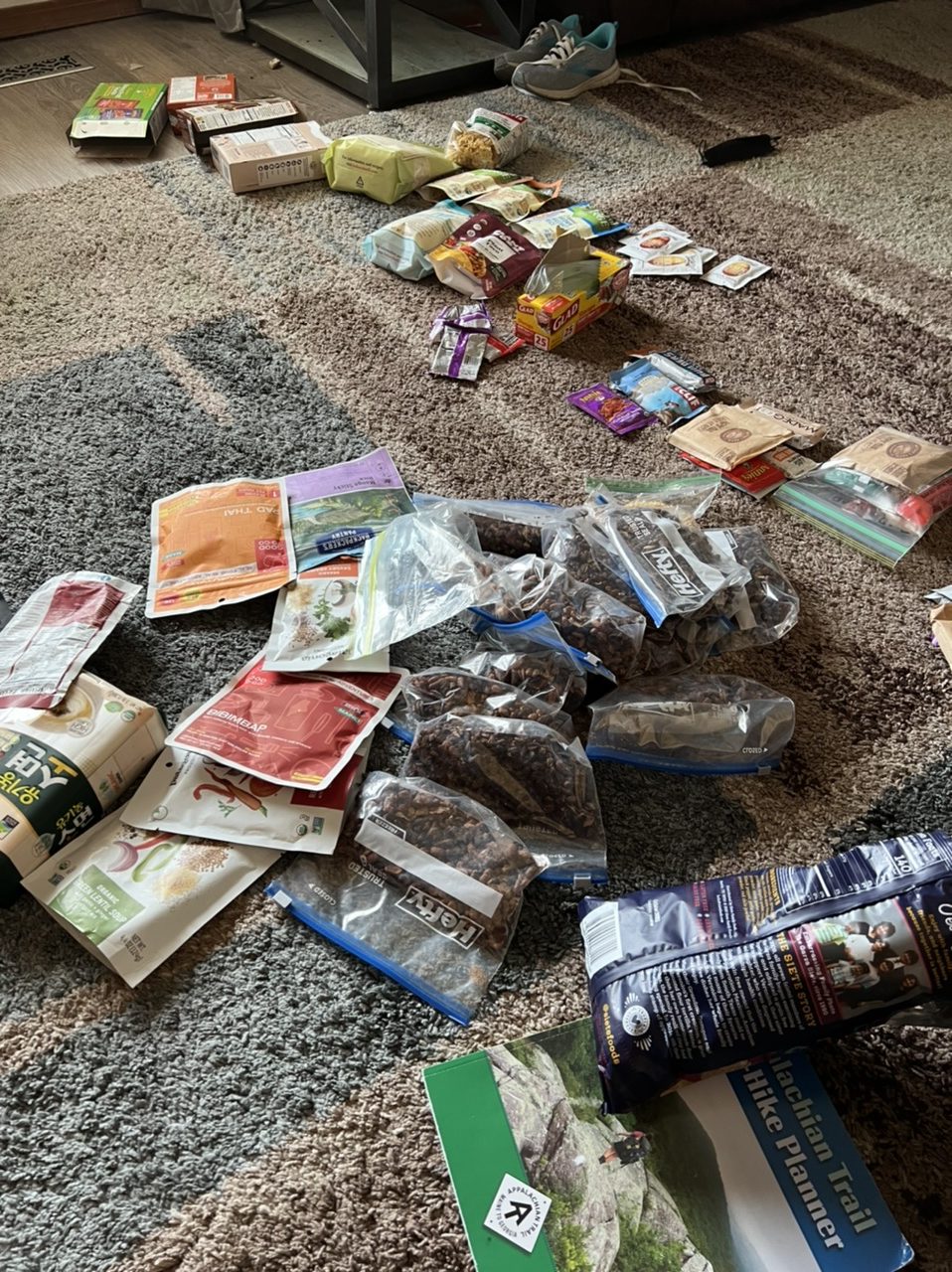
I want to continue cooking and dehydrating as many backpacking meals as possible, adding a few new recipes to our repertoire to avoid boredom on the trail.
There is still no plan as to how to actually get to Georgia. That is a big one to solve.
I don’t want to over do the mailing myself boxes while on the trail, but I know I want to at least have 6-10 for the trail. All filled with the meals currently being prepped, some with summer gear to swap out, some with other misc goodies. Still have a lot to plan with those, but luckily my mom is willing to actually do the mailing of said boxes when the times come.
I want to do more research on cold weather survival. What happens if all water sources are completely frozen? How to discover and treat hypothermia and frostbite. How to warm up in dire situations. Pretty much anything that may help ease discomfort and add more confidence.
I also want to get more familiar with different shelters and towns and such the first few hundred miles of the trail. I know there’s no point in planning each stop because so many things can change while on the trail. But it will give me a sense of comfort and confidence to at least be familiar with my options to create a loose plan. That’s part of my habit of over-planning, but I personally like being over prepared than under.
Appreciation
And mostly I want to slow down and truly appreciate a few things while I can. Warm clean sheets straight out of the dryer. A steaming hot bubble bath filled with epsom salts to soothe my fatigued muscles after a long day. Sharing dinner and conversation with my family. I have seemingly endless comforts as of now, and I want to be sure I don’t take them for granted.
I hope to do the same when I’m actually on the trail. Slow down and appreciate what it is I’m doing. Appreciate where I am. Acknowledge the accomplishments being made. At no other time in my life will I get to live life in the same way. Waking up with the birds, with lungs full of fresh air. Enjoying coffee with the sunrise. The anticipation of what will be experiences throughout the day.
As much as I’m looking forward to finally getting onto the trail, I am enjoying the planning for the Appalachian Trail process thoroughly as well.
60 Days Remain
30 Nov, 2021
A mere 60 days remain when I check the countdown I spent a solid half hour adding to my calendar 39 days ago. Two months until I officially step foot onto the Amicalola Falls approach for the Appalachian Trail (A.T.) in Georgia. That leaves eight weeks to finish the arduous task of researching, prepping, packing and planning for the Appalachian Trail.
The planning journey thus far
I’ve been living and thinking of little else for the past six months but the forthcoming six month hike I will embark upon. Planning for the A.T. has been a journey in and of itself, and it’s brutally exhausting in its own right. I’m not much of a shopper, and yet the vast checklist of needed items has meant I’ve been doing little else but shopping in my free time.
When they say your full set-up of gear will cost around $2,000-$3,000… well it turns out that is not an exaggeration.
I did have a few things already purchased that will work for my A.T. gear, including the costly purchases of my 65 liter backpack and my extremely warm but lightweight winter jacket. But there are many more things I need to acquire specifically since deciding upon a full on winter start date, including winter boots and spikes and heavier layers of clothing.
The current mountain
But currently, I am totally stuck on researching the purchase of an item that is especially important to me personally. The camera.
Since I was gifted my first point-and-shoot camera in the 7th grade, I’ve rarely been found without a camera in hand. To consider walking across the United States without a camera to capture and document all I see is pretty much unthinkable.
Up to this point I’ve always brought along my main camera along with me on hikes. The camera I use as a professional photographer. A whopping SIX pound camera in total. For a backpacker who literally is carrying everything needed to eat and drink and sleep on their back, that is a laughable amount of weight to add considering I’m aiming to keep my base weight no more than 25 pounds.
But to find a lightweight camera that meets my arguably high standards has been a difficult unicorn to find. I did find a couple that met my strict checklist fairly well, but one is backordered at every location that exists, and the other costs $6,000. Ouch. We expected a bit of difficulty due to supply chain issues in our current pandemic world, but it’s still a bummer reality to face.
How does one plan for a unique set of worries
Other than gear – the closer the 29th of January creeps, the more real everything feels. The excitement and anticipation, but also the worries and concerns. I finished reading yet another book about the AT last night, Appalachian Trials by Zach Davis, and as full of pumped up energy and “you can do this!” vibes it gave – it also, and importantly so, outlined all of the not so pretty realities found on the trail. The book is broken up into three parts, planning for the Appalachian Trail, hiking the trail, and what comes after you complete your thru-hike.
Concerns are understandably numerous when you’re making the unpredictable outdoors your home for half the year.
You have to simultaneously be prepared for any type of weather, while keeping your total pack weight bearable. A full-body tick check is mandatory every single day. Those Lyme disease carrying assholes can be found active even in winter, and especially through spring and summer. And of course, all of the typical what ifs. What happens if an injury occurs? How do we correctly treat hypothermia or frostbite? What happens if one freezing night my water filter cracks unbeknownst to me and I end up getting giardia?
Does a vegan thru-hiker exist?
A specific concern I have is about my diet. How do I confidently find enough nourishing and hearty vegan food while walking through 14 states? In my experience, small towns have very little in way of vegan options. And small mountain towns without even a Subway have even less. I have been able to find very limited resources when it comes to how to successfully consume a vegan diet while hiking the A.T. But I did read one interesting concept I hadn’t thought about before.
When it comes to eating vegan on a multi-day stretch of trail between towns, most people eat vegan foods anyway. Oatmeal, peanut butter, tortillas, Clif bars, nuts, trail mix, and ramen, among many other items, are popular backpacking staples for almost everyone.
So if hikers eat vegan foods anyway – as an unconscious decision – will it end up being that difficult for me?
The average hiker consumes upwards to 5,000 calories each day to maintain the level of energy they exert daily. My current diet primarily exists of vegetables, legumes, pasta, grains, and chocolate. Some of that won’t be too much of a problem; beans are especially a tasty dehydrated meal. But pasta generally takes too long to heat up on a small camp stove. And you can find fresh vegetables can only in a trail town.
So yeah, I’m a little concerned.
Mental preparation
But being prepared mentally is such a big part of success. After all, much of what we fear is actually the unknown. The what ifs. But having an idea for a course of action, or at least the conscious knowledge of a concern is helpful.
So finishing up my shopping checklist and reading and researching as much as possible so I am as physically and mentally ready as possible is what I’ll continue working on for these next 59 days as the planning for the Appalachian Trail journey ends, and the start of my hiking journey begins.
Guadalupe Peak - The Highest Point in Texas
20 Feb, 2021
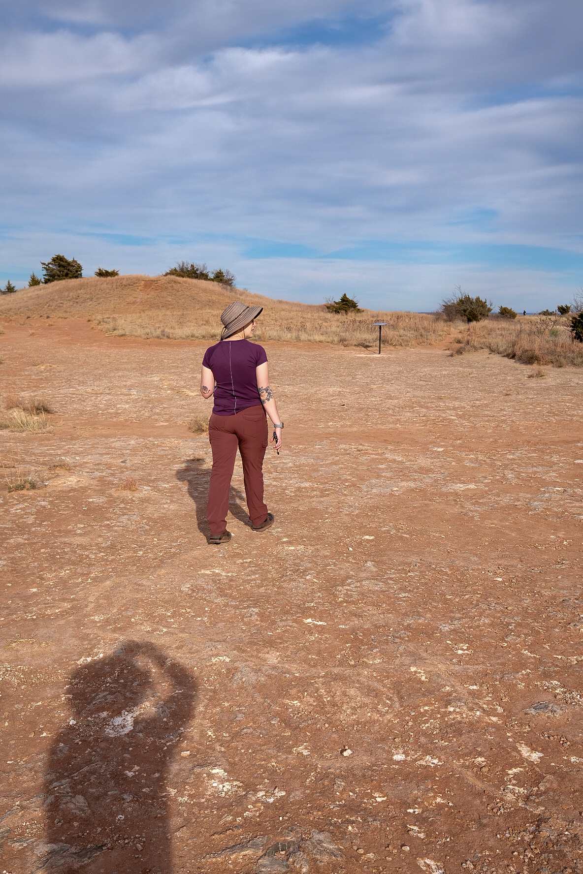
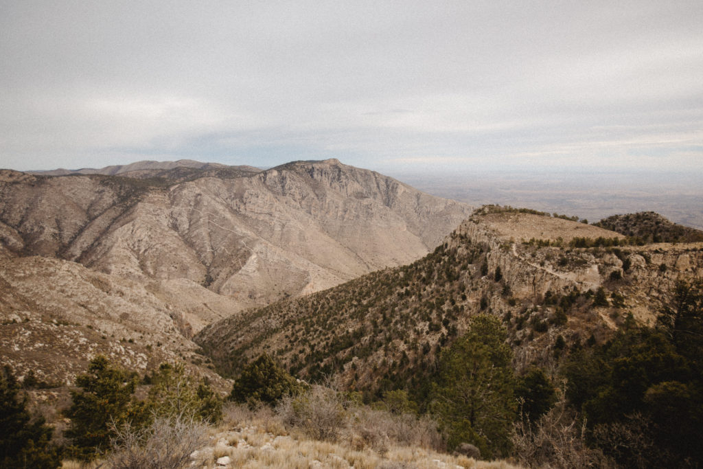
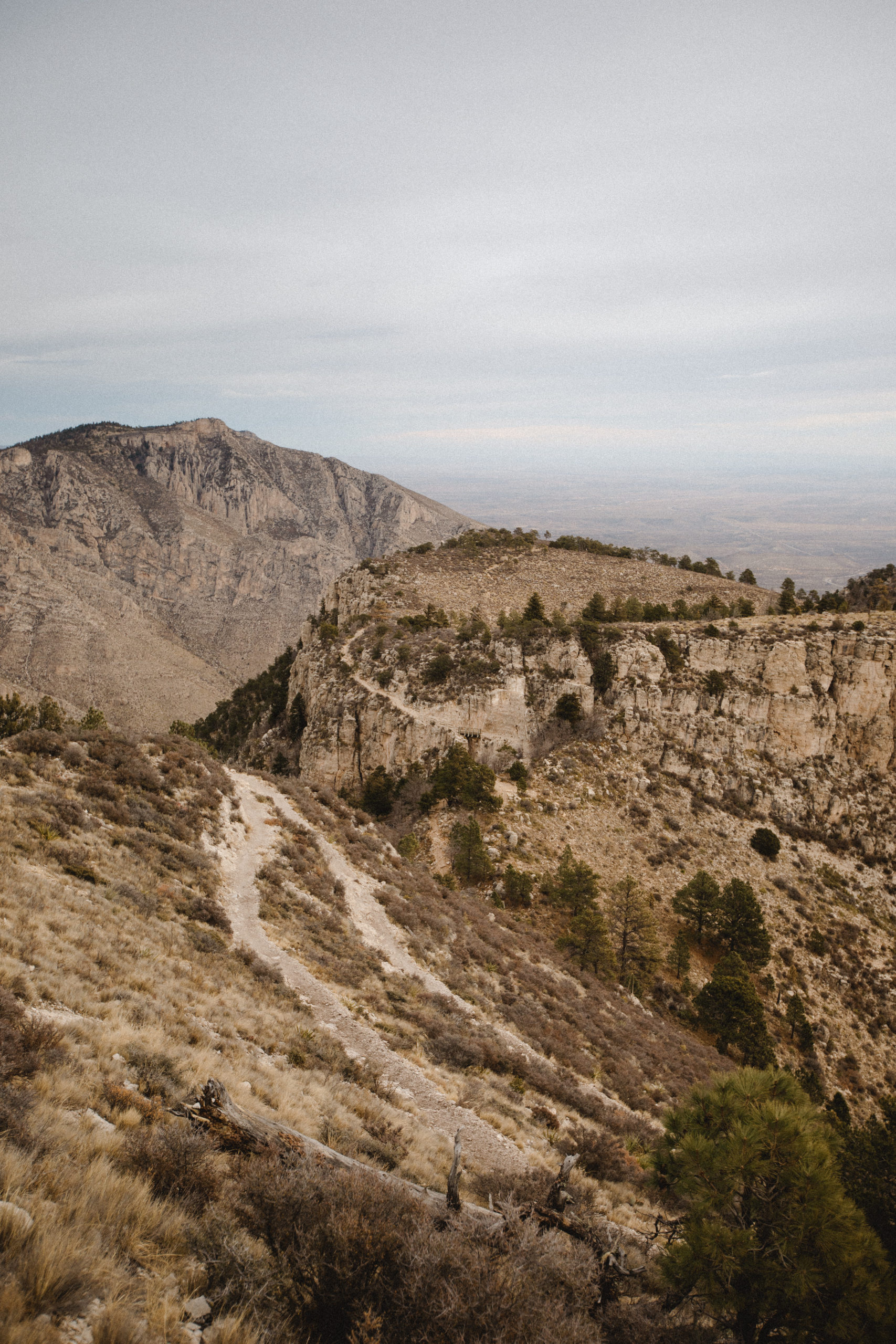
The highest point in Texas lies in the Guadalupe Mountains, 100 miles east of El Paso, Texas and 50 miles southwest of Carlsbad, New Mexico. High desert and mountain landscape mingle to create beautiful and unique scenery. Guadalupe Peak lies within the Guadalupe Mountain National Park giving visitors tons of recreation options in addition to summiting the peak.
Hiking the Guadalupe Peak Trail
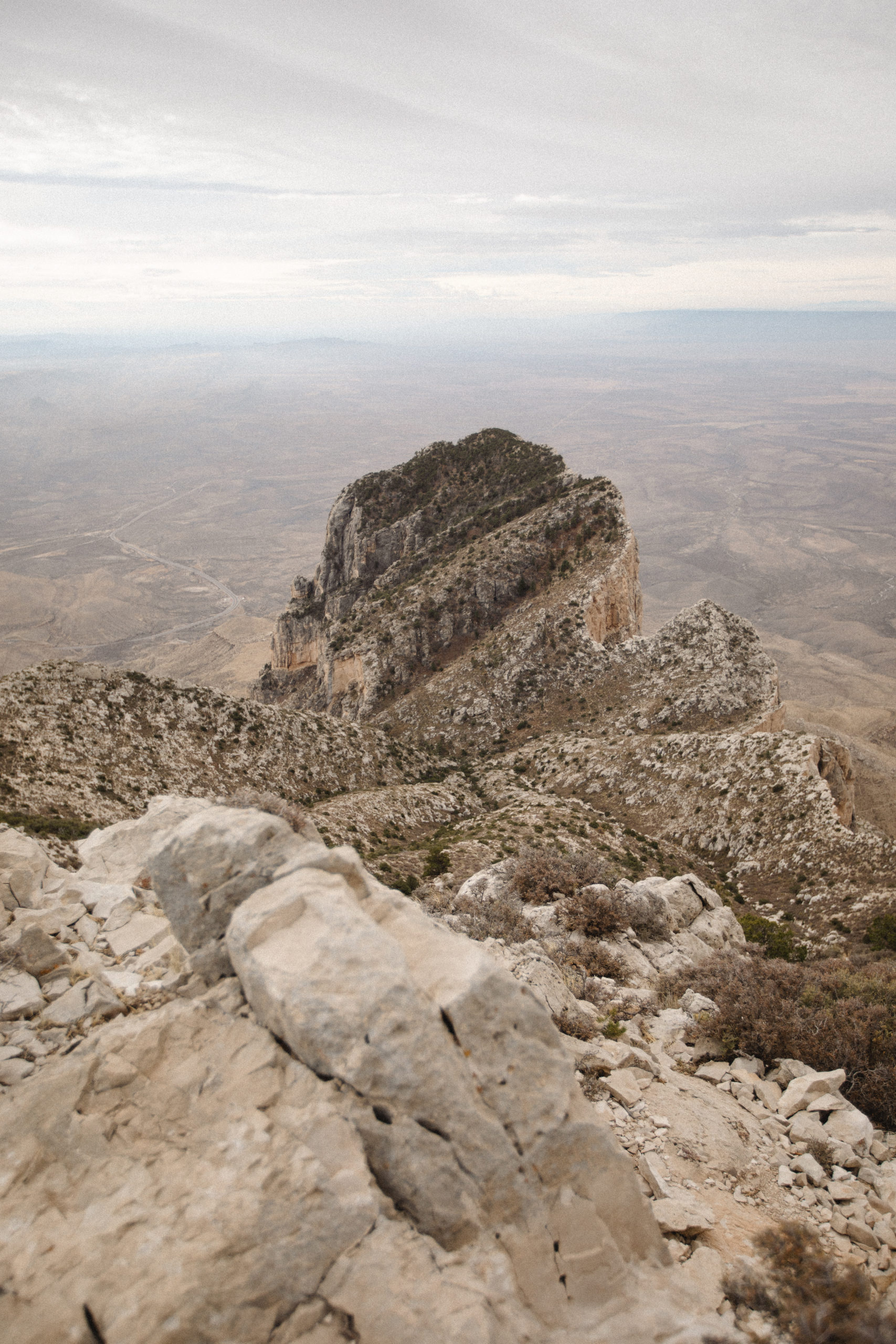
The first three miles of Guadalupe Peak Trail present the majority of difficulty in reaching the highest point in Texas. The last mile though, is quite nice and incredibly scenic as it meanders slowly to the summit. This was definitely my favorite mile of the trail, although that might have mostly been the fact that I dropped my 30+ pound backpack off at the spur trail to the camping sites instead of choosing to keep it on my back for the summit.
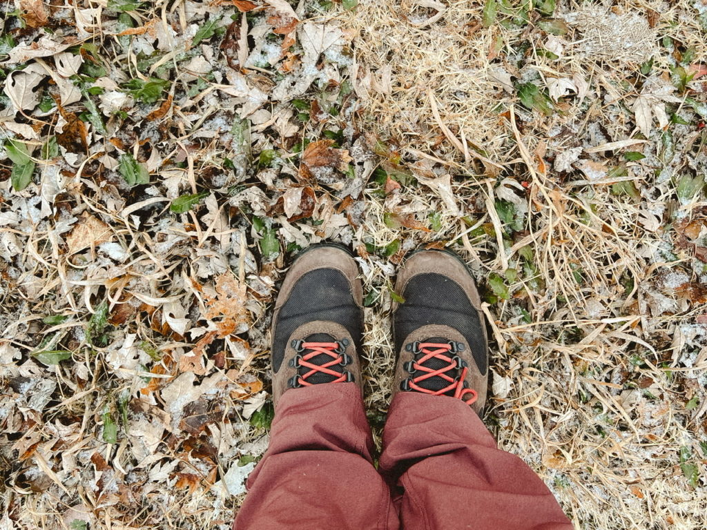
Winter Hiking in Texas
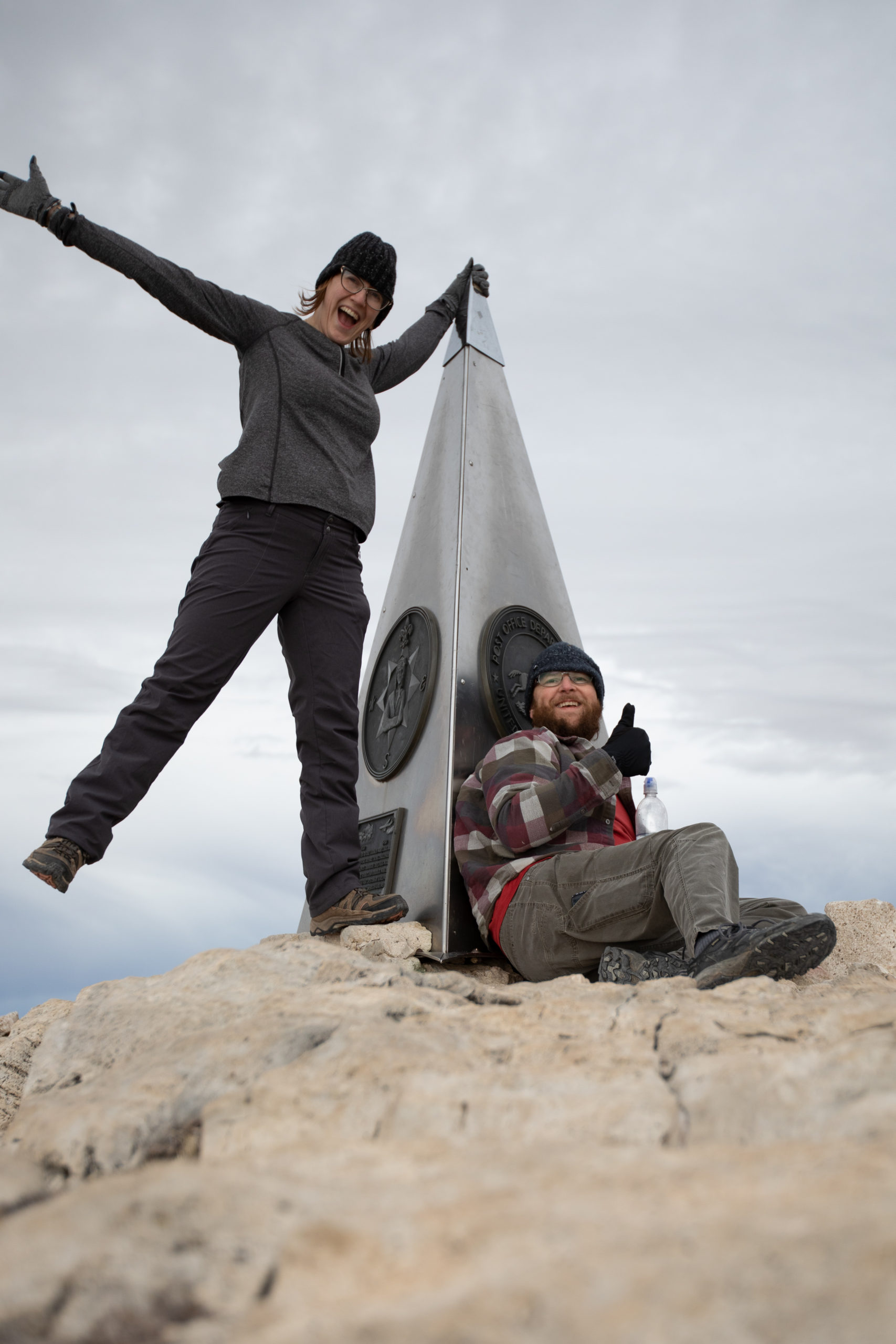
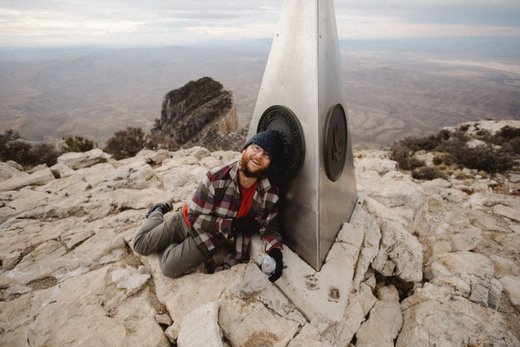
On the day my hiking partner and I hiked to Guadalupe Peak in January, the high was only about 53 degrees and there were wind gusts of up to 50 mph. We felt those gusts in their full power especially the last 20 or so minutes of the hike and of course on the summit. Amusingly enough (for only me though) this was where I learned of B’s heights+wind fear. He presented it by never standing up fully straight while on the summit itself, which poor guy, was hilarious to me. But we survived and ultimately had a great time of it exploring the summit, landscape and views.
The 8.5 mile roundtrip hike is certainly doable in one day if you are in adequate shape and bring plenty of water -seriously there is no water to be found on the mountain, you have to bring it with you and the park rangers recommend you drink a gallon of water per person per day – and snacks. Your total elevation gain is about 3,000 miles and being that your starting elevation is over 5,000 feet, it can be tough on lungs accustomed to a much lower daily elevation.
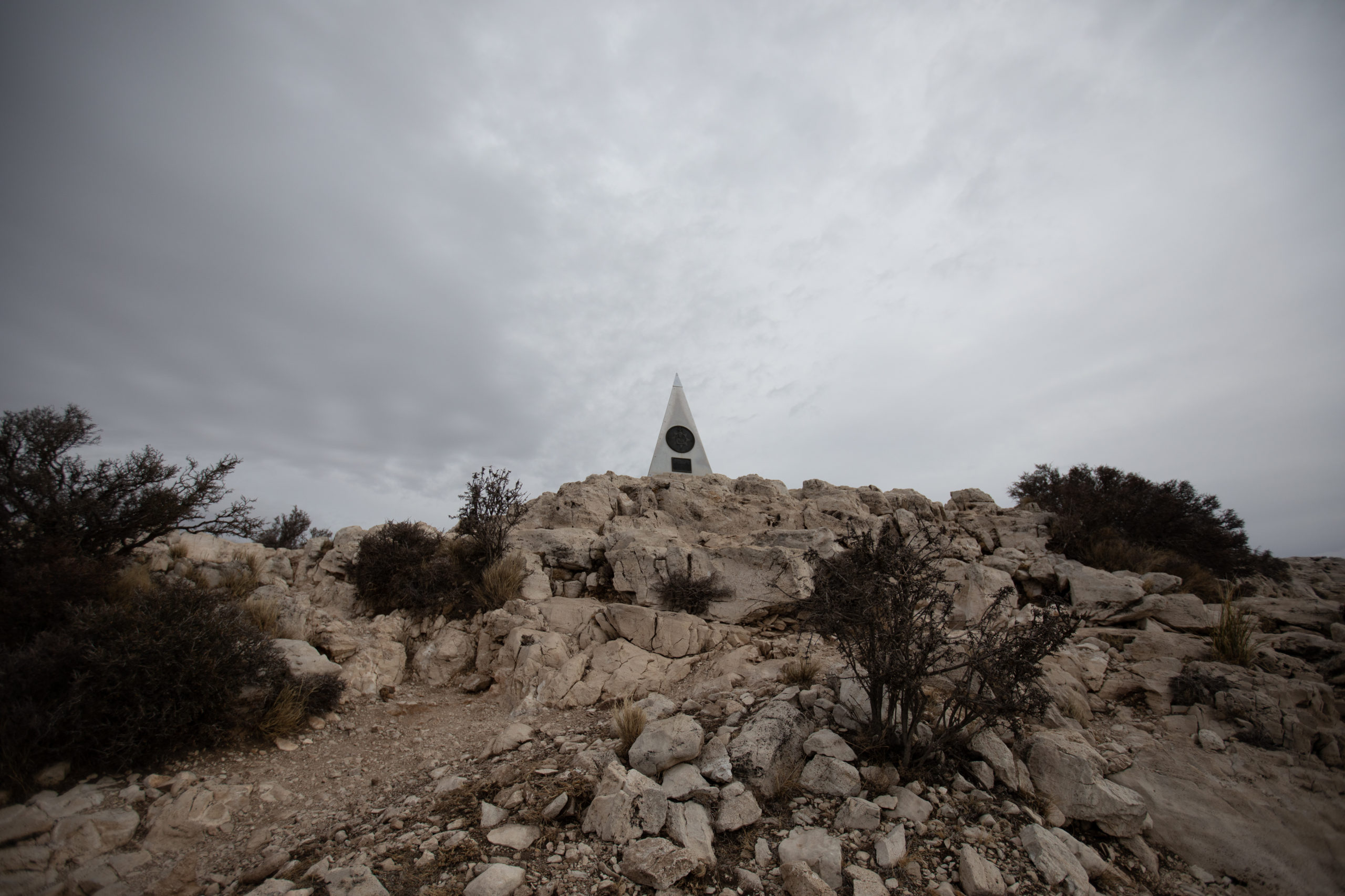
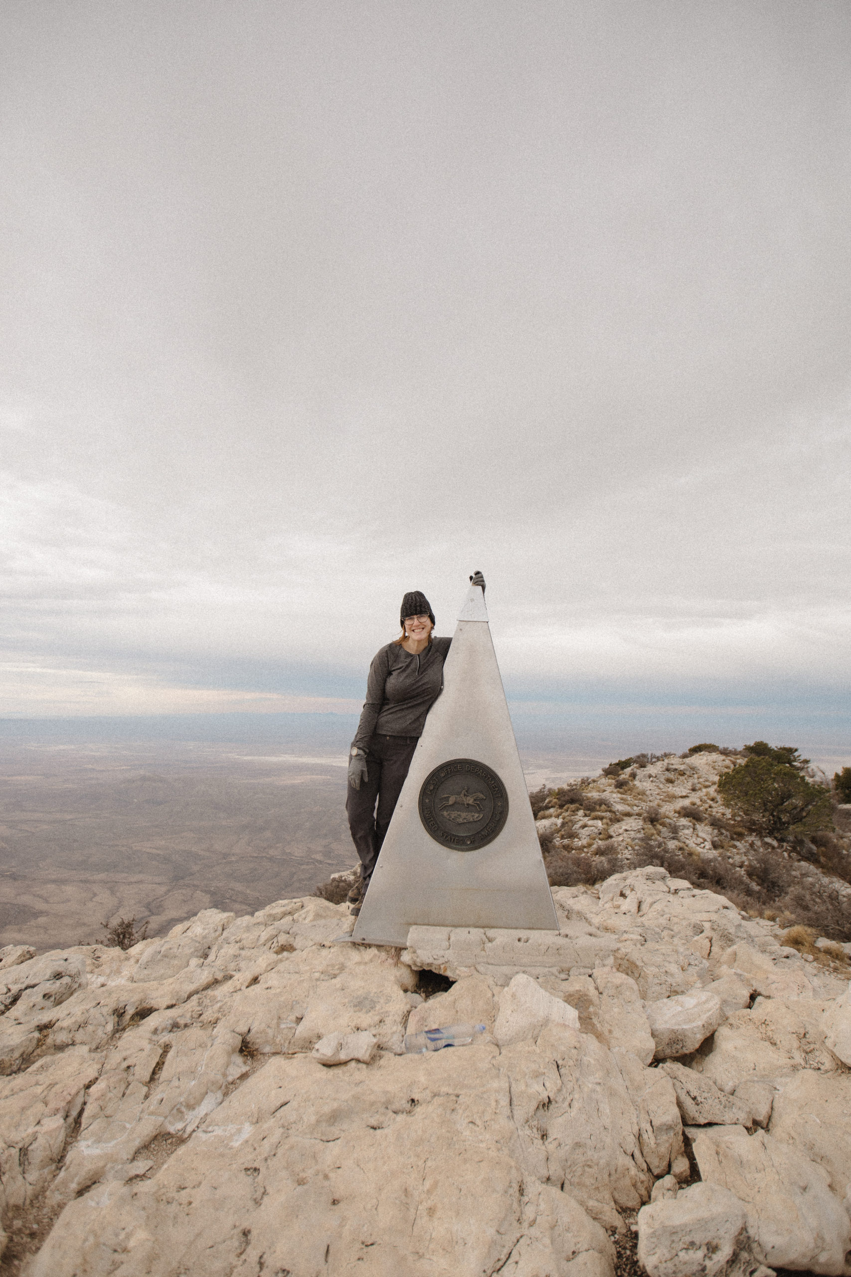
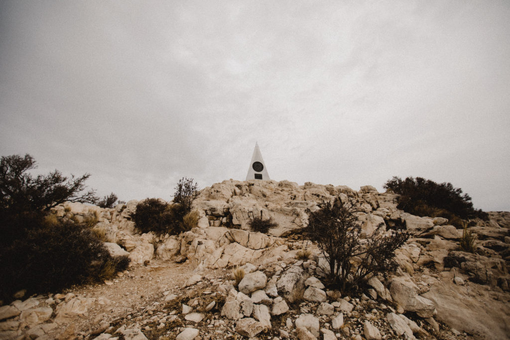
Guadalupe Peak stands at 8,751 feet over Texas and offers truly incredible views; not just at the summit but also along the majority of the trail itself. A tall stainless steel pyramid built in 1958 marks the summit. One side of the pyramid features a tribute to Pony Express Riders, the second side has the Boy Scouts of America logo and the third side shows the American Airlines logo who originally sponsored the pyramid.
There is a ton of useful information on the NPS website for those preparing on visiting the highest point in Texas themselves.